Dajti Mountain National Park
Albania /
Mat /
Klos /
World
/ Albania
/ Mat
/ Klos
World / Albania / Tiranë / Tiranës
invisible, national park


Dajti Mountain National Park is situated 26 km east of the capital and 50 km east of the Mother Teresa Airport. This park is highly frequented by day and is considered the 'Natural Balcony of Tirana'.
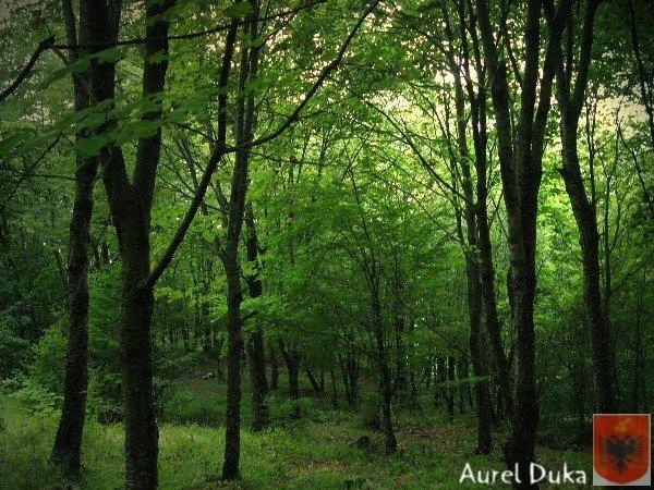
The 1966 area of 3,300 hectares protected since has been in the 21 of June 2006 expanded by many times. The core zone is now 9,000 hectares. In addition to the forests and the beautiful mountain landscape with many wild flowers is the protection of numerous mammals: In the park there are wild boar, eurasian wolf, red fox, European hare, brown bears and wildcats. In the lower part of the mountains the vegetation is scrub determined with much heath, myrtle and fragaria. Around the 1,000 metres altitude zone, oak dominates. It follows with beech forests with some conifers. Perched on the top there is almost no vegetation.
The mountain can be reached through a narrow asphalted mountain road onto an area known as Fusha e Dajtit. This was the location of a summer camp but now is the site of many restaurants. From this small area there is an excellent view of Tirana and its plain, that is why this place has often been named as the Balcony of Tirana. From June 2005, hikers and visitors of the mountain can use a gondola lift from the eastern outskirts of Tirana to Fusha e Dajtit (the field of Dajti) at 1050 meters altitude. On the summit of Dajti there are several transmitters of radio and television.
On Dajti traces of prehistoric settlements have been found. Also fortifications from later periods have been discovered.
Wikipedia article: http://en.wikipedia.org/wiki/Dajti_Mountain_National_Park
Nearby cities:
Coordinates: 41°24'2"N 19°58'12"E
- Rhodope National Park 329 km
- "Rodopi - Sredni" PZ under the Habitat Directive 397 km
- "Rodopi - Iztochni" PZ under the Habitat Directive 435 km
- Hohe Tauern National Park 904 km
- Küre Mountains National Park 1039 km
- Belovezhskaya Pushcha/ Białowieża 1311 km
- Gauja National Park 1825 km
- Valdaysky National Park 2090 km
- Jotunheimen National Park 2407 km
- Forollhogna National Park 2480 km
- Qafa e Qershisë 6.9 km
- Mali me Gropa 7.4 km
- Dajt Administrative Unit 7.6 km
- Brar Mountain 7.7 km
- Bovilla Lake 8.3 km
- Tirana District 11 km
- Tejlum (Tegjanët) 11 km
- Gamti mountain 12 km
- Krujë District 19 km
- Mat District 20 km