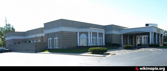
Cafe La Cave (DEMOLISHED) (Des Plaines, Illinois)
USA /
Illinois /
Rosemont /
Des Plaines, Illinois /
Mannheim Road (US 12 & US 45), 2777
World
/ USA
/ Illinois
/ Rosemont
World / United States / Illinois
historical layer / disappeared object
Add category
Nearby cities:
Coordinates: 42°0'10"N 87°53'1"W
- O'Hare Air Reserve Station 1 km
- Former Hawthorne Works 20 km
- Former Path of Ogden Avenue 21 km
- Reynolds Metals 22 km
- Peoples Gas Crawford Manufactured Gas Plant 22 km
- The site of the former Stinson Airport. 24 km
- A Century of Progress site 27 km
- Former Site of the Union Stock Yards 27 km
- Site of the Robert Taylor Homes 29 km
- World's Columbian Exposition site 33 km
- O'Hare Lake Office Plaza 1.4 km
- Bristol Court 2.2 km
- Maine South High School 2.5 km
- O'Hare International Airport (ORD/KORD) 3.2 km
- Centennial Park 3.2 km
- Des Plaines Methodist Camp Ground 3.5 km
- Maine Township 3.5 km
- Belleau Lake Forest Preserve 3.7 km
- Renaissance Business Complex 3.8 km
- Cook County, Illinois 21 km