Chesterman Beach
Canada /
British Columbia /
Ucluelet /
World
/ Canada
/ British Columbia
/ Ucluelet
World / Canada / British Columbia / Alberni-Clayoquot
beach
Add category
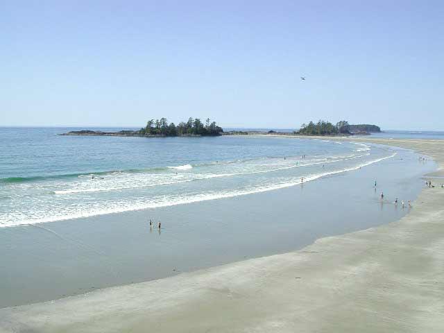
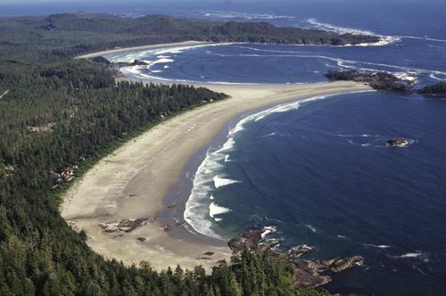
Chesterman Beach stretches for over 3 km, sweeping out to Frank Island, and then northward to the Wickaninnish Inn. The beach gets its name from John Phillip Chesterman who was an early white settler to the area. He acquired crown grants for the area in 1915 and lived on a homestead on the inlet side across from the beach that now bears his name. John Chesterman was a coxswain of the Tofino lifeboat and was a budding prospector trying to develop a copper and gold mine on Meares Island.
Chesterman Beach has been rated as one of the top 10 places in North America to learn surfing and has something to offer for both pro and beginner alike.
Chesterman Beach has been rated as one of the top 10 places in North America to learn surfing and has something to offer for both pro and beginner alike.
Nearby cities:
Coordinates: 49°6'59"N 125°53'48"W
- Kennedy Lake Provincial Park 23 km
- Juan De Fuca Provincial Park 123 km
- Tahsish-Kwois Provincial Park 161 km
- Sunset Beach State Recreation Site 361 km
- Cousins Inlet 385 km
- Conkle Lake Provincial Park 493 km
- Columbia River Hanford Reach 558 km
- Bullards Beach State Park 670 km
- North Beach 693 km
- Big Lagoon 891 km
- Cox Bay 1.7 km
- Wickaninnish Island 4.2 km
- Stubbs Island 5.3 km
- Meares Island 8 km
- Lemmens Inlet 9 km
- Vargas Island 10 km
- Catface Range 18 km
- McKay Island 25 km
- Flores Island (British Columbia) 29 km
- Hesquiat Peninsula Provincial Park 57 km