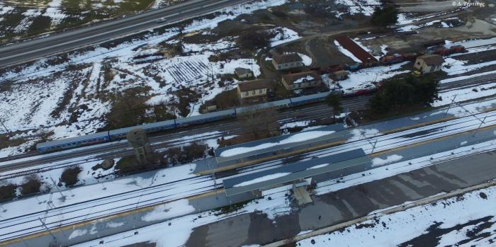
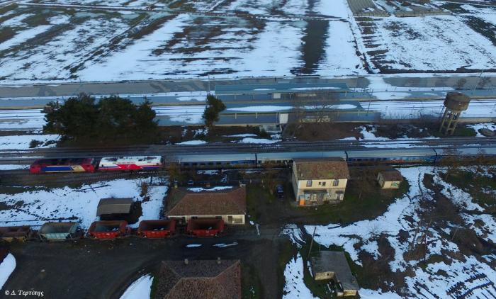
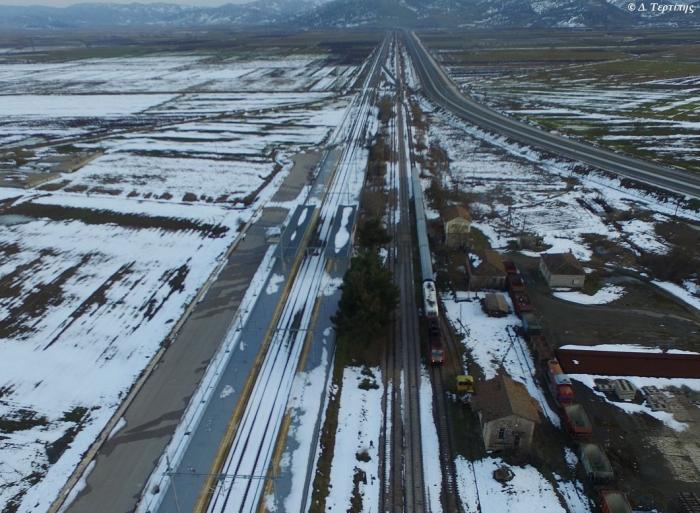
Angiae Rail Station
Greece /
Fthiytis /
Omvriaki /
World
/ Greece
/ Fthiytis
/ Omvriaki
, 9 km from center (Ομβριακή)
World / Greece / Thessalia
former railways
Add category


Nearby cities:
Coordinates: 39°5'27"N 22°11'26"E
- Fàrsala Rail Station 31 km
- Melià Rail Station 63 km
- Chàlki Rail Station 63 km
- Vòlos Rail Park 70 km
- Corinth Town Rail Station 144 km
- Mavrodèndri Rail Station 149 km
- Amyntaio Rail Station 183 km
- Gèfyra Rail Station 187 km
- Amphipolis Port Rail Station 237 km
- Former railway yards 3733 km
- Panagia Solar Field 2.1 km
- The ancient citadel (Acropolis) in the position of Island of Lake Xynias in the limits of the Village Koromilia 9 km
- Lake Metalleio. 11 km
- Settlement of Mines (Metallion) 11 km
- Agios Stefanos mine 11 km
- Railway Tunnel Othrios. 12 km
- Highway Tunnel (3000 m) 13 km
- Mount Othrys 35 km
- Peripheral unit of Karditsa 40 km
- Peripheral unit of Phthiotis 42 km
Panagia Solar Field
The ancient citadel (Acropolis) in the position of Island of Lake Xynias in the limits of the Village Koromilia
Lake Metalleio.
Settlement of Mines (Metallion)
Agios Stefanos mine
Railway Tunnel Othrios.
Highway Tunnel (3000 m)
Mount Othrys
Peripheral unit of Karditsa
Peripheral unit of Phthiotis