Cap Fagnet
France /
Haute-Normandie /
Fecamp /
World
/ France
/ Haute-Normandie
/ Fecamp
panoramic view, cape (geography), interesting place
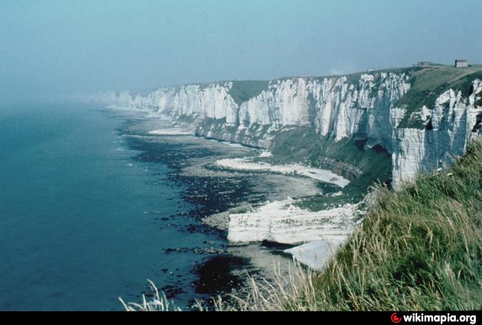
Cape Fagnet is one of the highest of the Alabaster Coast points, it offers a breathtaking panorama of the sea.
Nearby cities:
Coordinates: 49°46'3"N 0°22'5"E
- Sainte-Catherine hill 65 km
- The White Cliffs of Dover 169 km
- Oud stuk hellingbos 412 km
- Vrouwenheide geological monument 415 km
- Signal de Botrange summit (694m) 416 km
- Armed fruit along the highway: Banana 426 km
- Amstdamse Strekdam 433 km
- hill 464 km
- Oonwas with panoramical view 573 km
- Early Bourgeois Revolution in Germany 779 km
- Port de Fécamp 0.7 km
- Wind farm 1.2 km
- Lycées Maupassant & Descartes secondary schools 2.7 km
- Zone industrielle de Basbeuf 5.3 km
- Epreville 6.7 km
- Maniquerville 8.1 km
- Saint-Pierre-en-Port 10 km
- Rouville 19 km
- Valley of the Durdent 20 km
- piste d'atterrissage du camp Lucky Strike 22 km