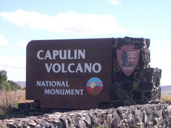
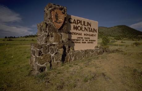
Capulin Volcano National Monument
USA /
New Mexico /
Folsom /
Volcano Road, 44
World
/ USA
/ New Mexico
/ Folsom
World / United States / New Mexico
park, monument, volcano, natural monument
44 Volcano Road
Capulin, NM 88414
(575) 278-2201
www.nps.gov/cavo/index.htm
www.nps.gov/carto/hfc/carto/media/CAVOParkMap.pdf
www.topoquest.com/map.php?lat=36.78171&lon=-103.97104&d...
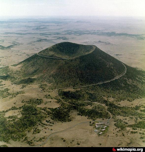
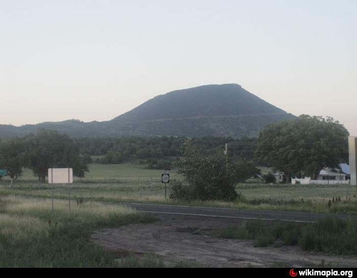
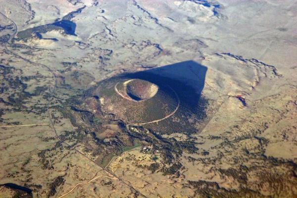
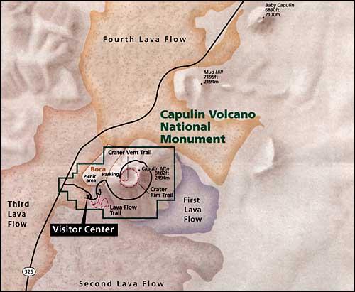
Capulin Volcano is approximately 4 miles in circumference at the base with a crater diameter of 1450 feet and an elevation of 8182 feet at the highest point.
A 2-mile paved road to the top of the volcano and paved trails into the crater and around its rim provide access to explore the volcano.
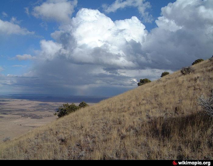
From the highest point on the crater rim trail on a clear day, visitors can see formations in Colorado, New Mexico, and Oklahoma. Some claim to see Kansas, but since there are no high points in western Kansas, it's hard to tell. The last formation in New Mexico to the east, Rabbit Ear Mountain, is visible on clear days and anything beyond it is Texas. (U.S. National Park Service)
Capulin, NM 88414
(575) 278-2201
www.nps.gov/cavo/index.htm
www.nps.gov/carto/hfc/carto/media/CAVOParkMap.pdf
www.topoquest.com/map.php?lat=36.78171&lon=-103.97104&d...
Capulin Volcano is approximately 4 miles in circumference at the base with a crater diameter of 1450 feet and an elevation of 8182 feet at the highest point.
A 2-mile paved road to the top of the volcano and paved trails into the crater and around its rim provide access to explore the volcano.
From the highest point on the crater rim trail on a clear day, visitors can see formations in Colorado, New Mexico, and Oklahoma. Some claim to see Kansas, but since there are no high points in western Kansas, it's hard to tell. The last formation in New Mexico to the east, Rabbit Ear Mountain, is visible on clear days and anything beyond it is Texas. (U.S. National Park Service)
Wikipedia article: http://en.wikipedia.org/wiki/Capulin_Volcano_National_Monument
Nearby cities:
Coordinates: 36°46'53"N 103°58'22"W
- Black Mesa Park 88 km
- Black Mesa State Park 97 km
- City Park 130 km
- City Park 139 km
- Nelson Park 157 km
- Cimarron National Grassland 181 km
- Willow Creek Park 188 km
- Thompson Park 221 km
- Centennial Park 223 km
- Medicine Arrow Park. 268 km
- Sierra Grande 8,720 ft (2,658 m) 13 km
- Raton-Clayton Volcanic Field 20 km
- Mesa de Maya 51 km
- Jesus Mesa 54 km
- Tecolate Mesa 75 km
- Pinon Canyon Maneuver Site 80 km
- Carrizo Mesa 90 km
- Black Mesa State Park Nature Preserve 91 km
- Cimarron County, Oklahoma 130 km
- Twin Buttes Wind Farm 140 km