Garrison Creek
Canada /
Ontario /
Toronto /
World
/ Canada
/ Ontario
/ Toronto
World / United States / New York
historical layer / disappeared object, arroyo (creek)
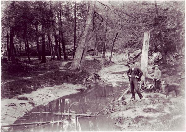
Garrison Creek was a short stream about 6 kilometres long that flowed southeast into the west side of Toronto Harbour in Ontario, Canada. It has been largely covered over and filled in, but geographical traces of the creek can still be found. The natural amphitheater known as Christie Pits is one such remnant; the south end of Trinity Bellwoods Park is another. The name "Garrison Creek" was used because Fort York was built just to the west of the creek mouth. It's banks formed the northern barrier of the Fort, and is today used by the railways to run to Union Station.
The river is completely buried in a series of underground culverts, but in Christy Pits it is close enough to the surface to provide some extra moisture to the grass above it, showing up as this green stripe. In winter it will melt off small amounts of snow, leaving a grassy stripe.
The path of the river can also be seen south of Bloor Street, following the series of parks and oddly curved streets.
Wikipedia article: http://en.wikipedia.org/wiki/Garrison_Creek
Nearby cities:
Coordinates: 43°39'30"N 79°25'0"W
- Niagara Escarpment 52 km
- Former rail line 99 km
- Former CN Coboconk Sub between Blackwater Jct. Coboconk via Cannington 115 km
- Former CN Rail - Fergus Subdivision alignment 117 km
- Former Rail alignment 129 km
- Former CN Rail - Kincardine Subdivision alignment 152 km
- Former railway alignment 157 km
- Former rail alignment 161 km
- Former CN Rail alignment 173 km
- Former CN Rail - Kincardine Subdivision alignment 188 km
- Bickford Park 0.3 km
- Bickford Park 0.3 km
- Commercial and entertainment area "Little Italy" 0.4 km
- Little Italy 0.6 km
- Fred Hamilton Park 0.7 km
- Garrison Creek 0.9 km
- Harbord Village 1 km
- Trinity-Bellwoods 1.2 km
- Little Portugal 1.6 km
- Old Toronto 2.9 km