Garrison Creek
Canada /
Ontario /
Toronto /
Bloor Street West
World
/ Canada
/ Ontario
/ Toronto
World / United States / New York
invisible, arroyo (creek)
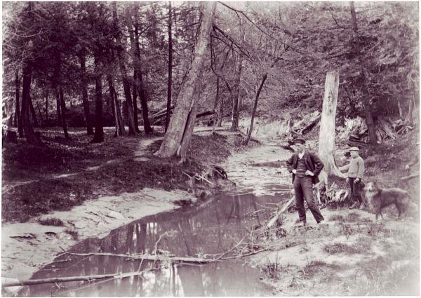
Garrison Creek was a short stream about 6 kilometres long that flowed southeast into the west side of Toronto Harbour in Ontario, Canada. The name "Garrison Creek" was used because Fort York was built overlooking the mouth at Lake Ontario.
The creek has been largely covered over and filled in, but geographical traces of its existence can still be found: the natural amphitheatre known as Christie Pits is one such remnant; the south end of Trinity Bellwoods Park is another. Natural low areas or dips along main roads such as Harbord just west of Grace, College at Crawford, Ossington between Dundas and College, Queen at Walnut, and Dovercourt just south of College are also remnants.
A large bronze plaque at the south-east entrance to Trinity-Bellwoods Park commemorates its existence and history.
Tributary streams include:
Stafford Stream (joining just south of King Street and heading to the former provincial asylum, now the Queen West - Center for Addiction and Mental Health)
Asylum Creek (from Queen and Lisgar to Garrison Common Park).
You can see a full map of Garrison Creek and its tributaries at www.lostrivers.ca/GarrisonCreek.htm
Wikipedia article: http://en.wikipedia.org/wiki/Garrison_Creek
Nearby cities:
Coordinates: 43°39'47"N 79°25'30"W
- Stoney Creek 56 km
- Hamilton City Centre 59 km
- Township of Adjala-Tosorontio 87 km
- Grand Valley 3 Wind Farm 90 km
- Township of East Luther - Grand Valley 92 km
- Amaranth Wind Farm 94 km
- Township of Oro-Medonte 120 km
- Township of Severn 139 km
- Township of Tiny 146 km
- Colpoy's Bay 192 km
- Bickford Park 0.6 km
- Dovercourt Park 0.6 km
- Dovercourt Park 0.6 km
- Dufferin Grove 1 km
- Bloor-Dufferin 1.1 km
- Harbord Village 1.6 km
- The Annex 1.9 km
- Forest Hill South 2.3 km
- Old Toronto 3.7 km
- Lake Ontario 118 km