Narrows Covered Bridge
USA /
Indiana /
Marshall /
World
/ USA
/ Indiana
/ Marshall
World / United States / Indiana
NRHP - National Register of Historic Places, covered bridge, 1882_construction


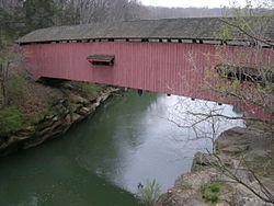
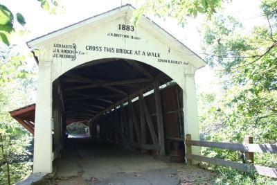
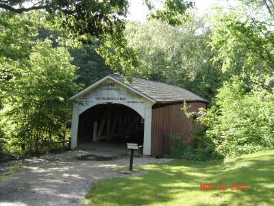
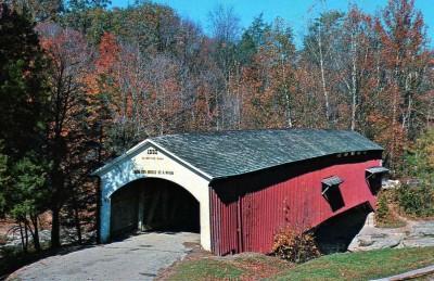
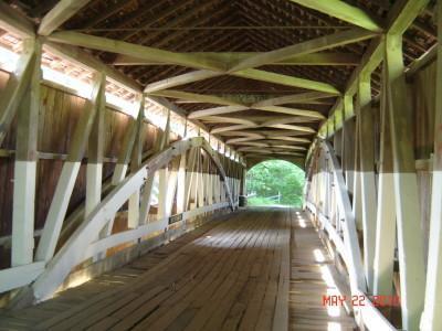
The Narrows Covered Bridge crosses Sugar Creek at the eastern edge of Turkey Run State Park and is a single span Burr Arch Truss covered bridge structure that was built by Joseph A. Britton in 1882. The bridge is 141 feet long, 16.5 feet wide, and 12.5 feet high.
Wikipedia article: http://en.wikipedia.org/wiki/Narrows_Covered_Bridge
Nearby cities:
Coordinates: 39°53'27"N 87°11'8"W
- Shadyside Recreation Area 131 km
- Bell Ford Bridge 149 km
- Roann Covered Bridge 156 km
- Restored Covered Bridge & Park 211 km
- Clearbranch Methodist Baptist Church and Covered Bridge 692 km
- Abandoned Bridge Piers 805 km
- Pennsylvania Railroad Bridge (Ruins/Demolished) 909 km
- Conowingo Bridge (Former Site) 939 km
- Port Deposit Bridge remnants 945 km
- Covered Bridge Park 1644 km
- Turkey Run State Park and Rocky Hollow Falls Canyon Nature Preserve 1.6 km
- Lake Waveland 8.6 km
- Parke County, Indiana 13 km
- Raccoon State Recreation Area 19 km
- Cecil M. Harden Lake 20 km
- Bridgeton, Indiana 27 km
- Glenn Flint Lake 28 km
- Montgomery County, Indiana 30 km
- Putnam County, Indiana 39 km
- DePauw University Nature Park 39 km