LZ-1 (Washington, D.C.)
USA /
District of Columbia /
Washington /
Washington, D.C.
World
/ USA
/ District of Columbia
/ Washington
World / United States / District of Columbia
helipad
Add category

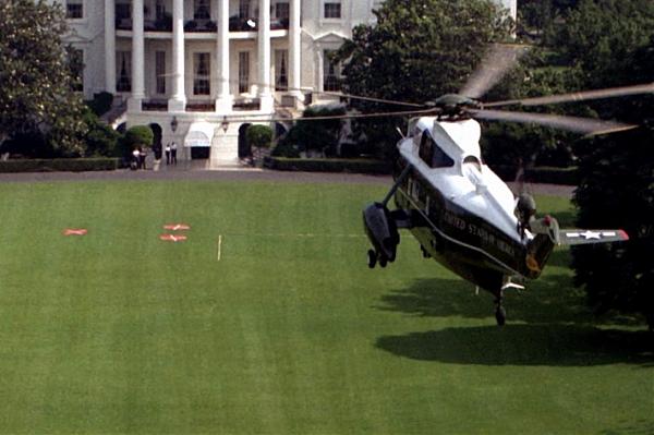

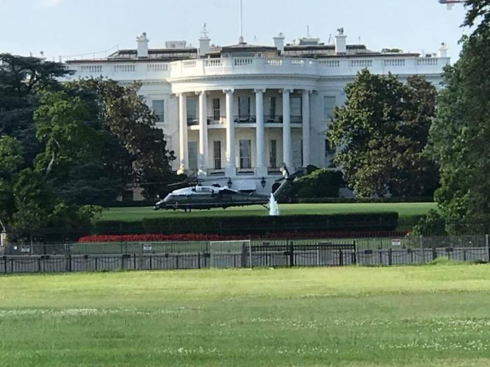
Designated landing zone (LZ) for Marine One and the other authorized elite MHX-1 "Nighthawks" Squadron helicopters. Unlike typical frequent-use helipads, this one is not paved. For aesthetic and security reasons, it is also not marked with a large letter H. Rather, for daytime arrivals, red circular X-marked pads are hauled out and emplaced temporarily by ground crew shortly ahead of time (the red-X disks are visible in the photos above). On some overhead images of the White House South Lawn, the narrow triangle formed by the three dots of worn turf where the X-disks are repeatedly placed is faintly visible.
Wikipedia article: http://en.wikipedia.org/wiki/Marine_One
Nearby cities:
Coordinates: 38°53'49"N 77°2'11"W
- Helipad with Approach Lighting System 222 km
- Helipad Area 243 km
- Old White Lake Airport 489 km
- Runway H5/H23 953 km
- US Army heliport 1151 km
- Helipad H1 1159 km
- Helipad H4 1160 km
- Helipad H3 1160 km
- Harold NOLF 1282 km
- NOLF Santa Rosa 1291 km
- President's Park 0.1 km
- Downtown 0.6 km
- Golden Triangle 0.9 km
- George Washington University 1 km
- Constitution Gardens 1 km
- Foggy Bottom 1.1 km
- The National Mall 1.2 km
- West Potomac Park 1.3 km
- Rock Creek Park 5.4 km
- Arlington County, Virginia 5.9 km
Comments