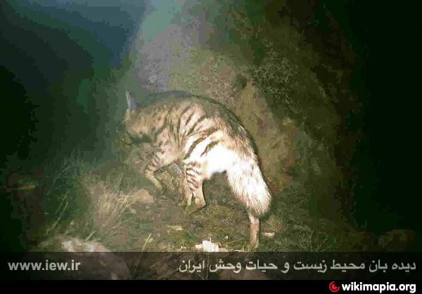
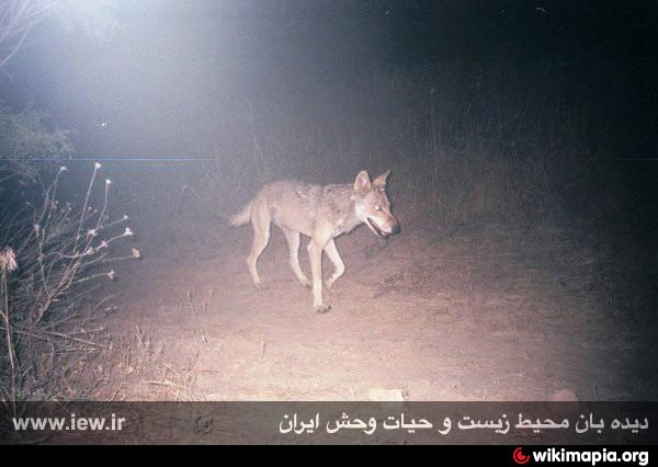
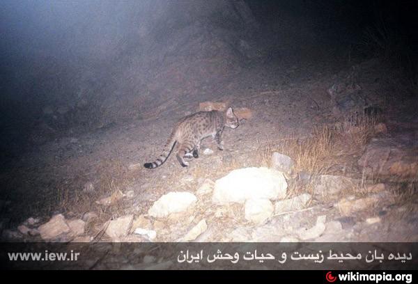
Angoran Protected Area
Iran /
Azarbayejan-e Gharbi /
Takab /
World
/ Iran
/ Azarbayejan-e Gharbi
/ Takab
, 45 km from center (تكاب)
World / Iran / Zanjan
nature conservation park / area
Add category
www.irandeserts.com/content/article/%D9%85%D9%86%D8%B7%... لینک مطلب در وب سایت کویرها و بیابان های ایران
www.irandeserts.com وب سایت کویرها و بیابان های ایران - جامع ترین سایت ایران شناسی
www.irandeserts.com وب سایت کویرها و بیابان های ایران - جامع ترین سایت ایران شناسی
Nearby cities:
Coordinates: 36°40'1"N 47°27'48"E
- Lake Urmia 273 km
- Central Alborz Protected Area 320 km
- Kabir Kuh - 3050 m 364 km
- Kavir Protected Area 391 km
- Kavir National Park 450 km
- Touran Wildlife Refuge 766 km
- Naybandan Wildlife Refuge 822 km
- Bahram-e Gur Protected Area 998 km
- Hamoun Wildlife Refuge 1372 km
- Bahookalat Protected Area 1743 km
- Pashtuk Mount 15 km
- The Hoodoos of Girmiz Mahnishan Valley ... Tent Rocks National Monument 17 km
- The Hoodoos of Ujubiz Valley ... Tent Rocks National Monument / length of 2900 meters 18 km
- Ghaterchi Canyon & Valley 20 km
- GHaley-e Behestan (Hoodoos) Tent Rocks National Monument 24 km
- The Hoodoos of Khalaj Valley ... Tent Rocks National Monument 26 km
- Sachi 26 km
- Galbe Mane Forest 29 km
- Hoodoos 33 km
- Aladaghlar Mahneshan National Geopark (Rainbow mountains) 43 km
Pashtuk Mount
The Hoodoos of Girmiz Mahnishan Valley ... Tent Rocks National Monument
The Hoodoos of Ujubiz Valley ... Tent Rocks National Monument / length of 2900 meters
Ghaterchi Canyon & Valley
GHaley-e Behestan (Hoodoos) Tent Rocks National Monument
The Hoodoos of Khalaj Valley ... Tent Rocks National Monument
Sachi
Galbe Mane Forest
Hoodoos
Aladaghlar Mahneshan National Geopark (Rainbow mountains)
Comments