Kabir Kuh - 3050 m
Iran /
Ilam /
Darrehshahr /
World
/ Iran
/ Ilam
/ Darrehshahr
, 15 km from center (دره شهر)
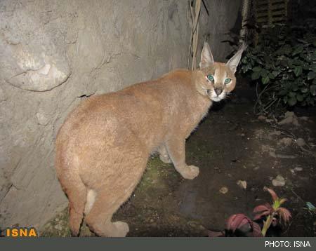
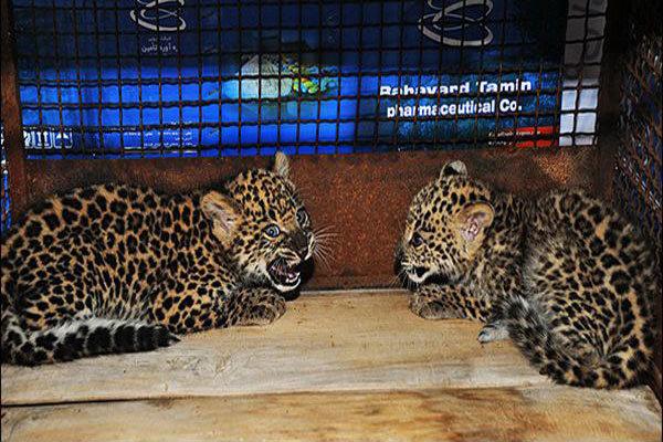
mount, protected area, mountain range
video :
www.youtube.com/watch?v=sUmm94oFK-E
foto :
filemantasvir.blogfa.com/
.
www.irandeserts.com/content/%D8%AF%D8%B1%DA%AF%D8%A7%D9...
www.mehrnews.com/news/2455313/%D8%AB%D8%A8%D8%AA-%D8%AA...
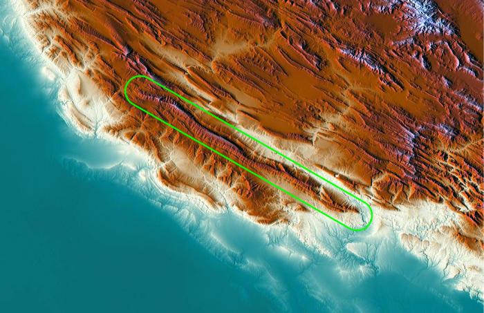
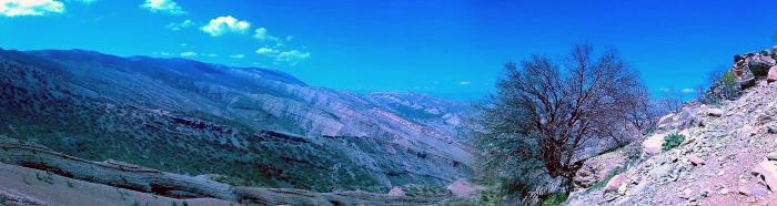
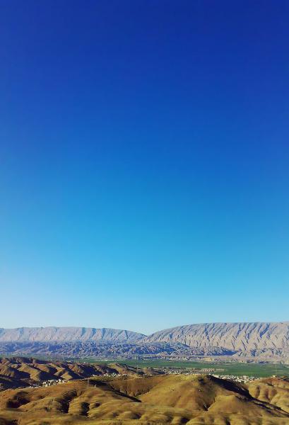
Kabir Kuh (In Persian: کبیرکوه ) is one of the long ranges of the Zagros Mountains near the border of Lurestan and Ilam Provinces in Ilam province, Iran.[2] Covering an area of 9,500 km2 (3,700 sq mi), Kabir Kuh stretches 175 km (109 mi) in length and 48–80 km (30–50 mi) in width along the Zagros Mountains in the Northwest-Southeast direction. It begins about 20 km (12 mi) south of Ilam and stretches down to the vicinity of Andimeshk in Khuzestan. Made mainly by Cretaceous sedimentary rocks,[3] the Kabir Kuh range consists of a large number of mountains, including Shah Ahmad, Tabriz, Kaleh-bad, Filman, Damaghey-e Anar, Rivasan, Puneh, Sabzkhani, Zarrin, Golgol that are covered by snow and ice all year round. Its highest peak is Kan Seifi with 3,050 m (10,010 ft) elevation, 50 km (31 mi) south of Ilam. Kabir Kuh runs along the Seymareh river, which becomes Karkheh when joins the Kashkan river before reaching the border of Ilam province and Khuzestan province. Kabir Kuh divides the mountainous region in western Iran into two regions generally referred as Piškuh (eastern side) and Poštkuh (western side), the latter virtually coinciding with Ilam.[4][5][6]
The eastern side is dominated by steep slopes where water and wooded valleys abound. The western side is, however, quite dry but rich in oil reservoirs and underground resources.[6]
www.youtube.com/watch?v=sUmm94oFK-E
foto :
filemantasvir.blogfa.com/
.
www.irandeserts.com/content/%D8%AF%D8%B1%DA%AF%D8%A7%D9...
www.mehrnews.com/news/2455313/%D8%AB%D8%A8%D8%AA-%D8%AA...
Kabir Kuh (In Persian: کبیرکوه ) is one of the long ranges of the Zagros Mountains near the border of Lurestan and Ilam Provinces in Ilam province, Iran.[2] Covering an area of 9,500 km2 (3,700 sq mi), Kabir Kuh stretches 175 km (109 mi) in length and 48–80 km (30–50 mi) in width along the Zagros Mountains in the Northwest-Southeast direction. It begins about 20 km (12 mi) south of Ilam and stretches down to the vicinity of Andimeshk in Khuzestan. Made mainly by Cretaceous sedimentary rocks,[3] the Kabir Kuh range consists of a large number of mountains, including Shah Ahmad, Tabriz, Kaleh-bad, Filman, Damaghey-e Anar, Rivasan, Puneh, Sabzkhani, Zarrin, Golgol that are covered by snow and ice all year round. Its highest peak is Kan Seifi with 3,050 m (10,010 ft) elevation, 50 km (31 mi) south of Ilam. Kabir Kuh runs along the Seymareh river, which becomes Karkheh when joins the Kashkan river before reaching the border of Ilam province and Khuzestan province. Kabir Kuh divides the mountainous region in western Iran into two regions generally referred as Piškuh (eastern side) and Poštkuh (western side), the latter virtually coinciding with Ilam.[4][5][6]
The eastern side is dominated by steep slopes where water and wooded valleys abound. The western side is, however, quite dry but rich in oil reservoirs and underground resources.[6]
Wikipedia article: https://en.wikipedia.org/wiki/Kabir_Kuh
Nearby cities:
Coordinates: 33°7'53"N 47°15'56"E
- Kuh-e-Sefid 241 km
- Sahand Mountain Range 543 km
- Sabalan Mountain Range 592 km
- Zangezur Mountains 757 km
- Gegham mountains 850 km
- Konar Zard Kuh 951 km
- Mulguzar Mountains 1971 km
- Yarkhun Range 2326 km
- Atbashi Range 2605 km
- Mazartag 2881 km
- Kabir kouh Protected Area 15 km
- Dinar Kooh protected area 21 km
- Kabir Kouh Tunnel - 8322 meters long each 24 km
- Saidmareh Landslide 37 km
- Siah Kooh (Black Mountain) 46 km
- Marzoo Mountain 51 km
- 5 برار مورموری ایلام 57 km
- Do Yarj Lake 60 km
- Taleghani 64 km
- Maysan Governorate 127 km