Owensboro High School Grounds (Owensboro, Kentucky)
USA /
Kentucky /
Owensboro /
Owensboro, Kentucky /
Frederica Street (US Route 431), 1800
World
/ USA
/ Kentucky
/ Owensboro
World / United States / Kentucky
high school, school yard
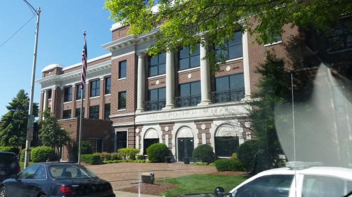
Wikipedia article: http://en.wikipedia.org/wiki/Owensboro_High_School
Nearby cities:
Coordinates: 37°45'29"N 87°6'48"W
- Warren East High School 105 km
- North Harrison Campus 106 km
- Floyd Central High School 122 km
- Fairdale High School 126 km
- Christian Academy of Indiana 129 km
- Kentucky Country Day School 147 km
- Christian Academy of Louisville - English Station Campus 151 km
- Franklin County High School 207 km
- Lexington Christian Academy 228 km
- Tates Creek Schools 232 km
- Dogwood Azalea 0.9 km
- Downtown Owensboro 1.6 km
- North Breckenridge 2 km
- Monarch Park 2 km
- East Riverfront Industrial District 2.6 km
- English Park 2.7 km
- West Parrish Commercial District 2.8 km
- Scottish Homes 3.2 km
- Yellow Bank Island 3.7 km
- Riverport Industrial District 4.7 km