Frank Lloyd Wright's Taliesin
USA /
Wisconsin /
Spring Green /
County Road C, 5481
World
/ USA
/ Wisconsin
/ Spring Green
World / United States / Wisconsin
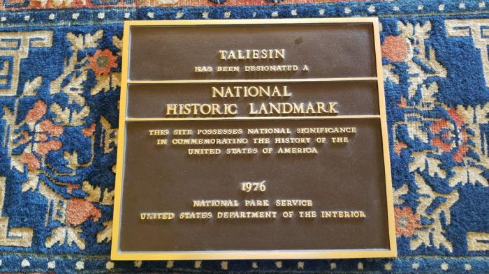
museum, estate (manor / mansion land), NRHP - National Register of Historic Places
Designed 1911-1959
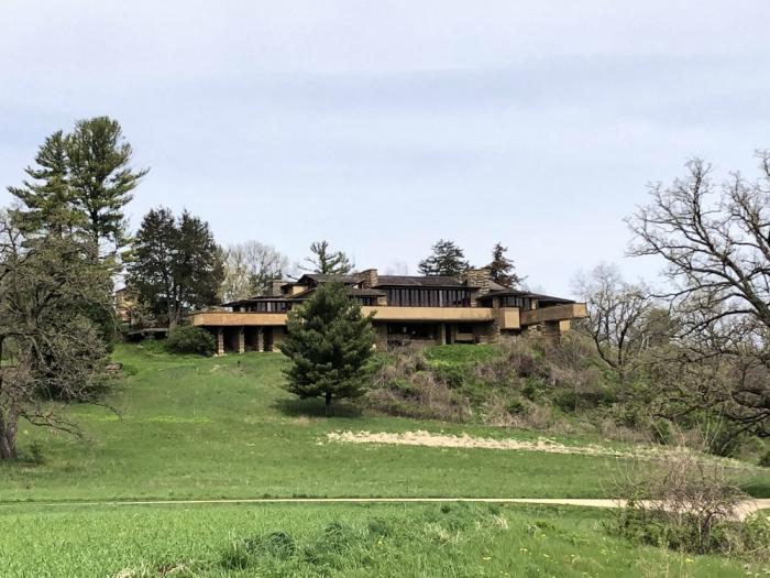
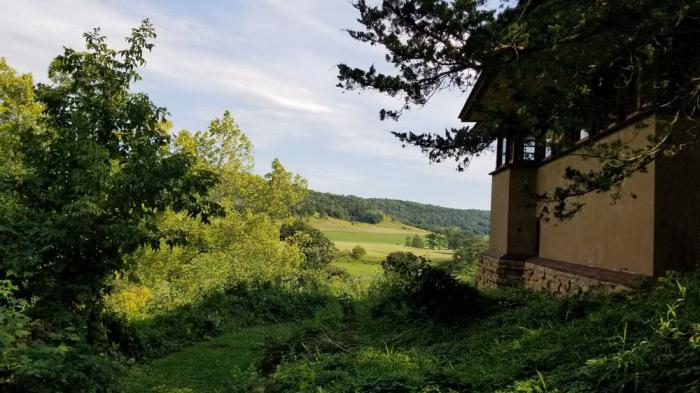
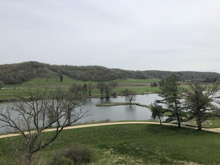
Wright's home in Wisconsin, Taliesin, was the longest ongoing architectural work of Wright's career. From the time he started building Taliesin in 1911 until his death in 1959, he never stopped changing it or adding to it. Some of the most significant changes followed fires that struck the living areas in 1914 and 1925; others were made on the spur of the moment as a new idea captured Wright's imagination. Wright called the three versions of his home Taliesin I (1911-14), Taliesin II (1914-25), and Taliesin III (1925-59).
Located on 600 acres, the 37,000-square-foot country estate includes living quarters, an office, drafting studio, farm buildings, and other structures. Everything from the landscaped grounds, roads and ponds, lighting, furnishings, and collected objects is a product of Wright's genius.
www.franklloydwright.org/
Wikipedia article: http://en.wikipedia.org/wiki/Taliesin_(studio)
Nearby cities:
Coordinates: 43°8'16"N 90°4'9"W
- The Landing, Minnesota River Heritage Park 332 km
- Boone and Scenic Valley Railroad 336 km
- Living History Farms 349 km
- Lower Sioux Agency History Center 423 km
- Heritage Park 425 km
- Forest History Center 532 km
- Minnesota Discovery Center 532 km
- Historic Prairie Village 581 km
- Ashfall Fossil Beds State Historical Park 666 km
- Stump Lake Village, Nelson County Historical Society, 834 km
- The House on the Rock Resort and Golf Course 2.1 km
- Lower Wisconsin River Parkway 2.6 km
- Tower Hill State Park 3.1 km
- House on the Rock 6.9 km
- Gotham, Wisconsin 20 km
- White Mound County Park 25 km
- Blue River Sand Barrens State Natural Area 38 km
- Ernstmeyer sub-division 47 km
- Boscobel Airport 49 km
- Wisconsin Secure Program Facility 50 km
Comments