SIGINT station
Cyprus /
Government controlled area /
Palaiomylos /
World
/ Cyprus
/ Government controlled area
/ Palaiomylos
World / Cyprus
military, military radar
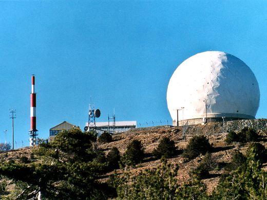

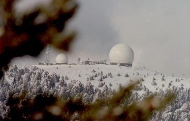

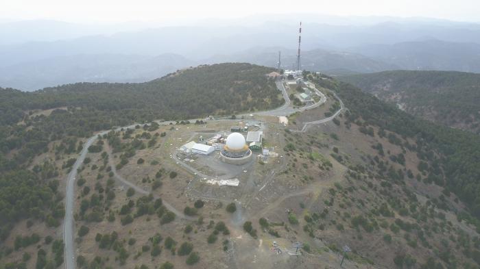
Signal intelligence station. It is belived to be a part of the ECHELON network covering Near East territories.
Wikipedia article: http://en.wikipedia.org/wiki/ECHELON
Nearby cities:
Coordinates: 34°56'15"N 32°51'44"E
- Episkopi Garrison 28 km
- RAF Akrotiri Western Sovereign Bases Area (of UK) 28 km
- United Nations Green Line 33 km
- Royal Air Force (RAF) Akrotiri 38 km
- Gurpinar Barracks / Large Turkish Army Base and Training Areas 42 km
- Paphos International Airport 43 km
- Turkish Army Turkeli Barracks 44 km
- Road Airbase 49 km
- Pashakoy 28th Mech.Infantry Division - Turkish Army 71 km
- Turkish Armed Forces - 61st Infantry Troop Regiment 77 km
- Mount Olympus 0.2 km
- Troodos Ski Resort 0.3 km
- Troodos mountain range 6.1 km
- Υδατοφράκτης Καλοπαναγιώτη (Kalopanagiotis Dam) 8.1 km
- Kykkos Monastery 12 km
- Pera Vasa 13 km
- Limassol District 21 km
- Nicosia District 26 km
- Paphos District 31 km
- United Nations Green Line 36 km