Sadd Al-Kafara
Egypt /
Giseh /
El Badrashin /
World
/ Egypt
/ Giseh
/ El Badrashin
, 19 km from center (بدراشين)
World / Egypt
ancient, dam, archaeological site
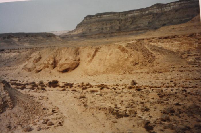
Sadd Al-Kafara, the first stone dam in human history.
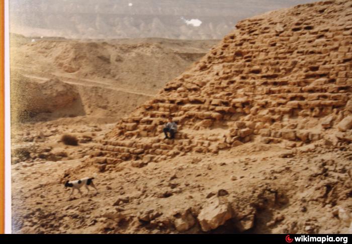
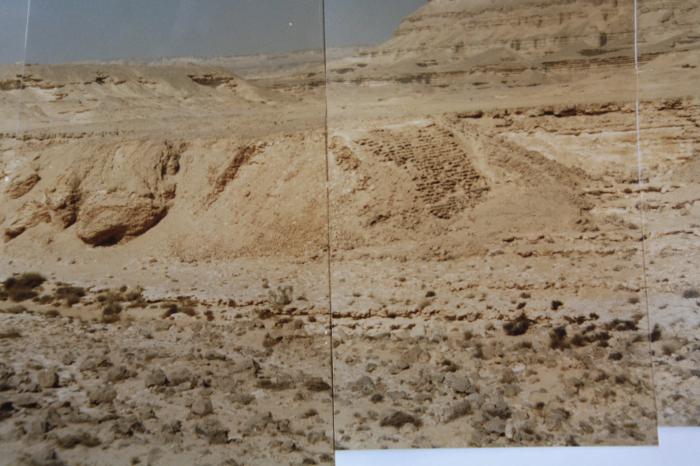
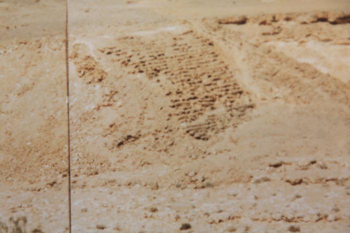
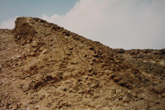
At some time between 2686 and 2498 BCE, the Ancient Egyptians labored for 10 to 15 years to build the world's first stone dam across this wadi. Shortly after it was built, it was destroyed in a flood, largely because the requisite knowledge on how to build a dam had not been worked out. The dam was made of two parallel stone walls, 24 meters wide at their bases and 11 meters wide at their tops, with a 36 meter space in between filled with rubble. The dam stretched 106 meters across the Wadi Al-Garawi.
The German archaeologist G. Schweinfurth, who studied Sadd Al-Kafara in 1885, calculated that the dam used 100,000 cubic meters of rock. Norman Smith wrote in his book 'History of Dams' that, had it worked, the reservoir would have had a capacity of about 600,000 cubic meters of water.
Strangely, there is no obvious reason why the Egyptians needed the water this dam would have held back. They had no agriculture going on in the vicinity, nor any towns. The only operation they were conducting nearby was an alabaster quarry. After Sadd Al-Kafara was destroyed, the Egyptians never attempted to dam a river again.
Unfortunately, since the end of 2oth century, the remains were more and more destroyed by uncontrolled limestone quarries up the valley and it will vanish soon completely. The photo shows its state in late 1990ies.
Nearby cities:
Coordinates: 29°47'44"N 31°25'54"E
- Dahshur Pyramids 22 km
- Ancient Saqqara 24 km
- Tahpanhes 139 km
- Wadi al-Jarf 152 km
- Tjaru 156 km
- Kellia 157 km
- Wadi Mukattab 220 km
- Akhetaten (Amarna) 241 km
- Amarna 243 km
- Mons Porphyritis 334 km
- Wadi Garawi 0.7 km
- Limestone Quarry 4.3 km
- Garbage Collectors District 15th of May 4.4 km
- Mogawra 29 مجاورة 5.4 km
- Mogawra 27 5.5 km
- Mogawra 28 مجاورة 5.7 km
- Mogara 30 مجاورة 5.9 km
- Cemetery 5.9 km
- مجاورة 22 6 km
- مجاورة 17 مدينة 15 مايو 6.8 km