Robinson's arch (Jerusalem)
Israel /
Jerusalem /
Jerusalem
World
/ Israel
/ Jerusalem
/ Jerusalem
World / Palestinian territories / West Bank
arch, archaeological site
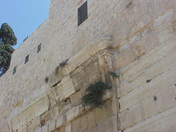
The large stone protruding from the southern part of the Western Wall, was discovered in 1838 and named after its discoverer, American researcher Edward Robinson. Archaeological excavations of 1968-1977 showed that the arch was a Temple archway, which spanned over paved streets, that supported a flight of steps leading from the street to the Temple Mount.
Wikipedia article: http://en.wikipedia.org/wiki/Robinson's_Arch
Nearby cities:
Coordinates: 31°46'33"N 35°14'4"E
- The Eye Arch 257 km
- Arch of Shigri 454 km
- Arch of the Industrial City 534 km
- Rainbow Arch 580 km
- Ctesiphon Arch (Taq Kasra) 890 km
- Door 1834 km
- Azure Window (Collapsed March 8, 2017) 1997 km
- Porta Rosa 2029 km
- ARCH OF MARCUS AURELIUS 2075 km
- Bachike'le' Arch 2139 km
- The Old City of Jerusalem 0.4 km
- Mount Zion 0.5 km
- Mount Moriah 0.6 km
- Ras al-Amud 1.1 km
- Mount of Olives 1.1 km
- Abu Tor 1.2 km
- East Jerusalem 1.7 km
- Gush Etzion 13 km
- Judea and Samaria ("West Bank") 19 km
- Judea 24 km