AT&T Cheshire CT
USA /
Connecticut /
Cheshire /
Higgins Road, 851
World
/ USA
/ Connecticut
/ Cheshire
World / United States / Connecticut
telecommunication, microwave tower / microwave transmission, underground station, telephone switch, underground facility, cell site / cell tower, landline telephone service provider, underground station entrance / exit, underground storage tank


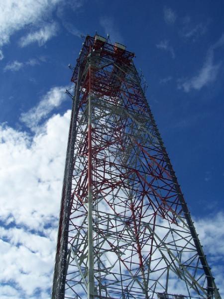
AT&T Main Station on the Boston to Miami L4 cable. Used to be an AUTOVON (military network) switch; thus is hardened against nuclear attack (facility goes several stories underground).
AT&T Long Lines Microwave Tower
AT&T Long Lines Microwave Tower
Wikipedia article: http://en.wikipedia.org/wiki/Autovon
Nearby cities:
Coordinates: 41°29'15"N 72°55'42"W
- Spruce Mountain Radio Site 209 km
- Ascutney South Radio Site 221 km
- Moose Mountain Radio Site 255 km
- AT&T Tully "Underground Cold War Network" Long Lines 303 km
- Cumberland County Communications 323 km
- Manns Hill Radio Site 333 km
- Terry Mountain Radio Site 349 km
- Streaked Mountain Radio Site 369 km
- Plymptonville Cell Site 471 km
- Peaked Mountain Radio Site 475 km
- Cheshire, Connecticut 1.5 km
- Prospect, Connecticut 3 km
- Broad Brook Reservoir 6.1 km
- Sleeping Giant State Park 7.3 km
- Quinnipiac University 8.2 km
- New Haven County, Connecticut 10 km
- Quinnipiac River State Park 10 km
- Choate Rosemary Hall, Secondary School 11 km
- Tyler's Mill/MTB/Motocross 13 km
- West Rock Ridge State Park 14 km