Tell al-Jumou'
Syria /
Dara /
Nawa /
World
/ Syria
/ Dara
/ Nawa
, 6 km from center (نوى)
World / Syria / Dar`a
archaeological site, fortification, tell (mound)
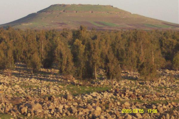
"Mound of the Crowds"
So-called because it was the gathering place of the Islamic Army during the time of Caliph Omar Ibn al-Khattab's, whereby the army, headed by Khalid ibn al-Waleed, gathered at the top of it before advancing towards conquest of Damascus from the Byzantine Empire.
So-called because it was the gathering place of the Islamic Army during the time of Caliph Omar Ibn al-Khattab's, whereby the army, headed by Khalid ibn al-Waleed, gathered at the top of it before advancing towards conquest of Damascus from the Byzantine Empire.
Nearby cities:
Coordinates: 32°51'35"N 35°59'56"E
- Tel al-Jabiyah 8.1 km
- Tell al-Harra 24 km
- Tell Kroum 35 km
- Tel 'Ireed 40 km
- Tell Zuweitineh (793) 45 km
- Tell Trinjeh 46 km
- Tall Hadid (938) 49 km
- Army hill base 69 km
- Tell Yizreel 71 km
- Shomron 100 km
- Artillery Army Base 3.6 km
- Tasil Reservoir 4.1 km
- Nawa Subdistrict 4.5 km
- Battlefield of the Battle of Yarmouk 5.8 km
- Army Brigade 61 HQ 6 km
- Army base 6.7 km
- Army Terrain 7.9 km
- Daraa Governorate (PCS) 15 km
- Horan Plain 16 km
- Quneitra Governorate (PCS) 30 km