Stockbridge
United Kingdom /
England /
Upper Clatford-Abbotts Ann /
World
/ United Kingdom
/ England
/ Upper Clatford-Abbotts Ann
World / United Kingdom / England
village
Add category

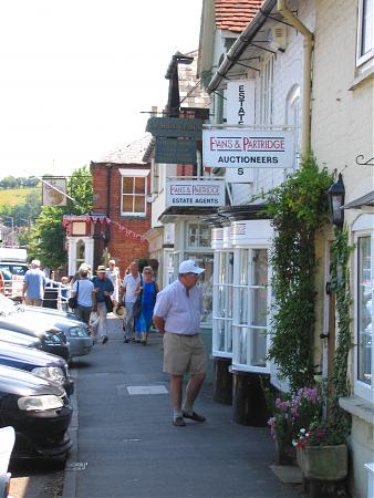


Stockbridge is a mid-rise conservation-area centred village of a little under 600 people in mid-Hampshire, England. A large public fountain, cafes, shops and a church form a focus for surrounding smaller villages for some miles. It is surrounded by rolling Grade I agricultural land largely comprising chalk-rich fields which are generally cultivated and woodlands along the river diverted through unusual fishing channels through the village nucleus. The river is the Test, which rises roughly on the county's border with Berkshire.
Wikipedia article: http://en.wikipedia.org/wiki/Stockbridge,_Hampshire
Nearby cities:
Coordinates: 51°6'54"N 1°29'36"W
- Broughton 5.8 km
- The Wallops 8.7 km
- Wellow Parish 15 km
- Chilworth 16 km
- Copythorne Parish 18 km
- Marchwood 24 km
- Brockenhurst 33 km
- Lymington 38 km
- Pennington 40 km
- Corfe Mullen 53 km
- AAC Middle Wallop 6.2 km
- Farley Mount Country Park 8.2 km
- South Harewood Forest 8.7 km
- DSTL Porton Down 13 km
- Romsey Parish 15 km
- MoD Boscombe Down 18 km
- Borough of Basingstoke and Deane 25 km
- New Forest National Park 28 km
- Salisbury Plain 31 km
- The Salisbury Plain Training Area 32 km