Horologium Augusti (Rome)
Vatican City /
Rome /
Piazza de Monte Citorio
World
/ Vatican City
/ Vatican City
/ Vatican City
World / Italy / Lazio / Roma
place with historical importance, sundial, Roman Empire, historic town square
From the superb Livius webpage:
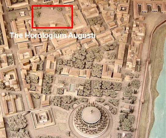
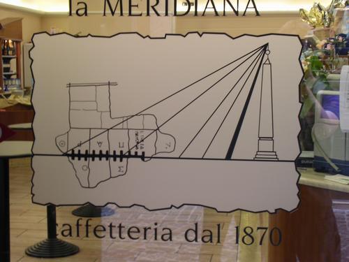
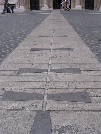
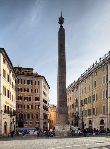
One of the most remarkable monuments in imperial Rome is the Horologium Augusti ("Clock of Augustus"), a giant sundial, using as its gnomon an obelisk that was originally made by a pharaoh named Psammetichus II (Neferibra Psamtik, 595-589). It was created by the emperor Augustus, who had conquered Egypt and had seized the monolith in Heliopolis. The obelisk, 21.79 meters high, is now standing in front of the Italian parliament and is again used as a sundial (a line in the pavement indicates the date). The monument is described by Pliny the Elder:
"Augustus used the obelisk in the Field of Mars in a remarkable way - namely to cast a shadow and thus mark the length of days and nights. A paved area was laid out commensurate with the height of the monolith in such a way that the shadow at noon on the shortest day might extend to the edge of the paving. As the shadow grew shorter and longer again, it was measured by bronze rods fixed in the paving. This device deserves study; it was the result of a brainwave of Facundus Novius." [Pliny, Natural history 36.72; tr. John Healy]
Images used by permission of Livius: www.livius.org/a/italy/rome/horologium/horologium_augus...
For more information from Wikipedia, follow the URL below.
Wikipedia article: http://en.wikipedia.org/wiki/Solarium_Augusti
Nearby cities:
Coordinates: 41°54'3"N 12°28'42"E
- Piazza d'Aracoeli 0.6 km
- Quaranta Martiri's Square 162 km
- Piazzale Donatello 231 km
- piazza ferretto 401 km
- Kossuth Tér (Kossuth Square) 652 km
- Plaoshnik 698 km
- Liberty Square 811 km
- Széchenyi Square 821 km
- Timisoara pedestrian area 822 km
- Union Square 944 km
- Rome historical centre 0.3 km
- Colonna 0.4 km
- Pigna 0.4 km
- Campo Marzio IV 0.7 km
- Ponte 0.8 km
- Regola 0.9 km
- Campitelli 1.3 km
- Trastevere 1.4 km
- Gianicolo 1.5 km
- Prati 2.2 km