Buena Vista Park (San Francisco, California)
USA /
California /
San Francisco /
San Francisco, California
World
/ USA
/ California
/ San Francisco
World / United States / California
park, hill, place with historical importance


Buena Vista & Haight Street
San Francisco, CA 94117
(415) 831-5500
sfrecpark.org/Facilities/Facility/Details/Buena-Vista-P...
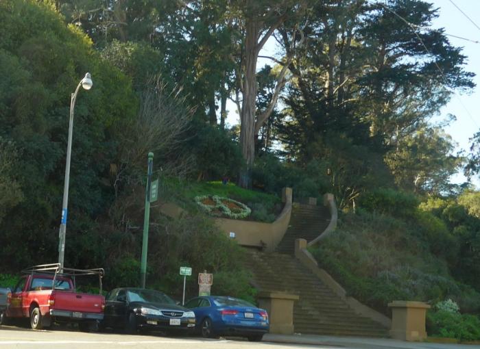
Oldest official San Francisco park, established 1867, predecessor to Golden Gate Park. Steep hill, offering spectacular views of the city -- highest elevation 575 feet -- originally covered by the sand dunes which stretched from Ocean Beach to the west all the way east to the old downtown wharves on Montgomery Street, and the Bay. (see Doris Sloan, Geology of the SF Bay Region, UCPress 2006, p.120, map 12 pp.114-5.)
San Francisco, CA 94117
(415) 831-5500
sfrecpark.org/Facilities/Facility/Details/Buena-Vista-P...
Oldest official San Francisco park, established 1867, predecessor to Golden Gate Park. Steep hill, offering spectacular views of the city -- highest elevation 575 feet -- originally covered by the sand dunes which stretched from Ocean Beach to the west all the way east to the old downtown wharves on Montgomery Street, and the Bay. (see Doris Sloan, Geology of the SF Bay Region, UCPress 2006, p.120, map 12 pp.114-5.)
Wikipedia article: http://en.wikipedia.org/wiki/Buena_Vista_Park
Nearby cities:
Coordinates: 37°46'6"N 122°26'27"W
- Muir Woods National Monument 22 km
- Mount Tamalpais State Park 23 km
- Bolinas Lagoon 29 km
- Mount Tamalpais Watershed 37 km
- Samuel P. Taylor State Park 41 km
- Olompali Ranch Historic Park 48 km
- Drake's Estero 58 km
- Tomales Bay State Park 58 km
- Tomales Point 72 km
- Point Reyes National Seashore 73 km
- Haight-Ashbury 0.4 km
- Lower Haight 0.8 km
- Eureka Valley 0.8 km
- Castro District 0.9 km
- Western Addition 1.4 km
- Parnassus Heights 1.6 km
- Twin Peaks 1.8 km
- Noe Valley 2.4 km
- Inner Sunset 2.4 km
- San Francisco Bay 15 km
Comments