Big Bear Lake (Big Bear Lake, California)
USA /
California /
Big Bear Lake /
Big Bear Lake, California
World
/ USA
/ California
/ Big Bear Lake
World / United States / California
lake
Add category


Elevation: 6744 feet (2056 meters)
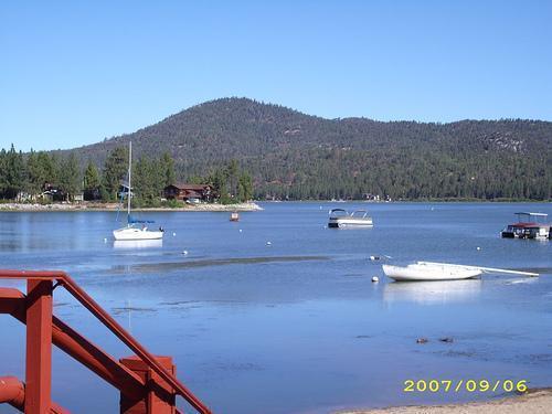
Big Bear Lake is a reservoir in the San Bernardino Mountains in San Bernardino County, California, USA. It has an east-west length of approximately 3.5 miles (6 km) and is approximately 2.5 miles at its widest measurement though most the Lake's width averages a little more than 1 mile (2 km). These approximations are based on the Lake having an optimum retainable water level. At dam's end Big Bear measures its deepest water at 72 feet (22 m). It is a completely snow-fed lake having no other means of tributary or mechanical replenishment.
Big Bear Lake is a reservoir in the San Bernardino Mountains in San Bernardino County, California, USA. It has an east-west length of approximately 3.5 miles (6 km) and is approximately 2.5 miles at its widest measurement though most the Lake's width averages a little more than 1 mile (2 km). These approximations are based on the Lake having an optimum retainable water level. At dam's end Big Bear measures its deepest water at 72 feet (22 m). It is a completely snow-fed lake having no other means of tributary or mechanical replenishment.
Wikipedia article: http://en.wikipedia.org/wiki/Big_Bear_Lake
Nearby cities:
Coordinates: 34°15'2"N 116°55'49"W
- Salton Sea 112 km
- Danby Lake 158 km
- Searles Lake 178 km
- Laguna Salada 214 km
- Lake Havasu 232 km
- Owens Valley Lake 274 km
- Lake Mead: Boulder Basin 282 km
- Lake Mead: Virgin Basin 304 km
- Lake Mead 319 km
- Lake Mead: Overton Arm 332 km
- Big Bear Village 1.9 km
- Fawnskin, California 2.1 km
- China Garden 3.7 km
- Snow Summit 4.4 km
- YMCA Camp Whittle 4.8 km
- Camp Tahquitz (Long Beach Area Council, BSA) 9 km
- Rim Nordic Ski Area 11 km
- Snow Valley Mountain Resort 11 km
- San Bernardino National Forest 22 km
- San Andreas Fault Zone (approximate) 30 km