water lock (Opole)
Poland /
Opolskie /
Opole
World
/ Poland
/ Opolskie
/ Opole
World / Poland / Opole
water, lock (water navigation)
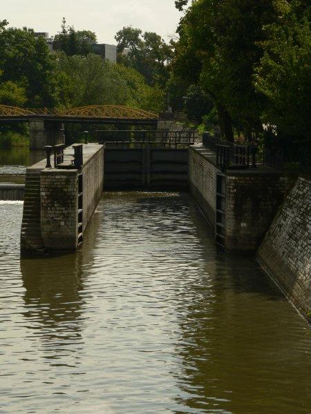


Built in 1886 as a part of port at Mlynowka. Port operated from 1860 to 1913, when a larger port in Zakrzow (to the north, outside of city) was built.
Lock was still actively used in 1980s with kayaks and other small boats going through it. Currently unused.
Lock was still actively used in 1980s with kayaks and other small boats going through it. Currently unused.
Nearby cities:
Coordinates: 50°40'6"N 17°55'10"E
- Mlynowka channel 0.2 km
- "Piast" pond 1.9 km
- "Bolko" pond 2.1 km
- flooded gravel pit 3.6 km
- Lake Turawskie 14 km
- Great Lake Pond 19 km
- Dębowa Reservoir 42 km
- Korzkiew Lake 50 km
- Jezioro Nyskie 54 km
- Dam Slezska Harta 86 km
- Opole Amphitheater 0.2 km
- Mlynowka channel 0.5 km
- Pasieka Island 0.5 km
- "Pamieci Sybirakow" bridge 0.6 km
- Odra river park 0.6 km
- Jan Kazimierz square 0.7 km
- City Center (district) 0.9 km
- Urban Landscaping Company 1 km
- old cemetery 1.1 km
- "Zaodrze" district 2.2 km