The Kimberley Big Hole (Kimberley)
South Africa /
Northern Cape /
Kimberley /
S Circular Road
World
/ South Africa
/ Northern Cape
/ Kimberley
World / South Africa / Northern Cape
mine, diamond mine
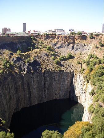
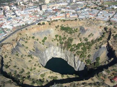
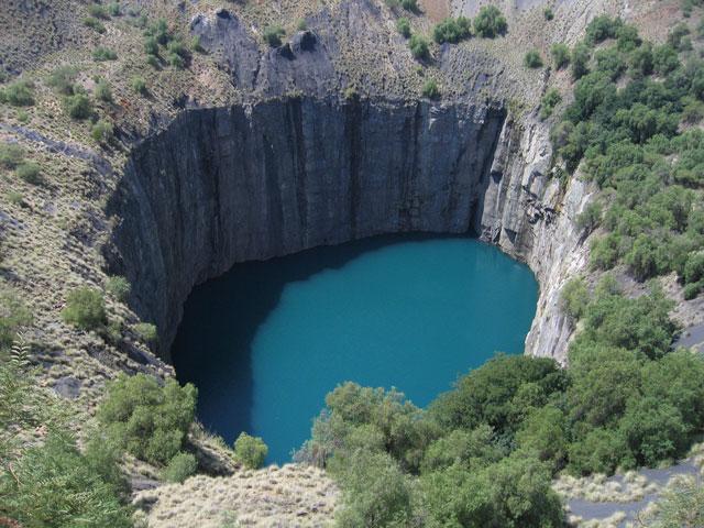
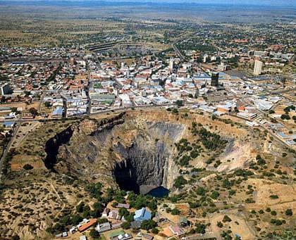
Open diamond mine operated by De Beers Consolidated Mines Ltd until 1914 and the center of the diamond rush in the 19th century.
Ground level photo by K. Ganey.
Ground level photo by K. Ganey.
Wikipedia article: http://en.wikipedia.org/wiki/Kimberley_Big_Hole
Nearby cities:
Coordinates: 28°44'20"S 24°45'30"E
- Anglo American Kolomela Mine 198 km
- Beatrix Gold Mine 202 km
- St. Helena Gold Mine 206 km
- Welkom Gold Mine 210 km
- Sishen Iron Ore Mine 211 km
- Target Gold Mine 215 km
- Virginia Operations - Merriespruit 1 218 km
- Hilton Gold Project 220 km
- Kalagadi Manganese Mine 258 km
- Makulu Manganese mine 275 km
- Military Base Kimberley 6.8 km
- Kamfers Dum 7.4 km
- Kimberley Airport 7.5 km
- Flamingo Park Racecourse 7.7 km
- ROADSPAN 11 km
- Droogfontein Solar Power 14 km
- Koffiefontein Solar Farm 38 km
- Boshoff Solar Power Plant 52 km
- Koffiefontein Diamond Mine 80 km
- Kalkfontein Dam 100 km