Changki
India /
Nagaland /
Mokokchung /
Mariani - Mokokchung Road...
World
/ India
/ Nagaland
/ Mokokchung
World / India / Nagaland / Mokokchung
village
Add category


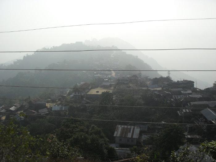
Changki village lying on top of the Changkikong range at an altitude of 1100 mts. is one of the biggest Ao villages in Mokokchung district.
Changki village was said to be founded by a man named Changki, and so the range too was named after him as Changkikong.
Spectacular views of the Changki valley right below and the Japukong range towards north and west directions. Plains of Assam are also visible far away.
Changki village was said to be founded by a man named Changki, and so the range too was named after him as Changkikong.
Spectacular views of the Changki valley right below and the Japukong range towards north and west directions. Plains of Assam are also visible far away.
Nearby cities:
Coordinates: 26°25'6"N 94°23'30"E
- Khensa 11 km
- Mangmetong 13 km
- Mopungchuket 14 km
- Impur 16 km
- Yisemyong Compound 19 km
- Lakhuti 20 km
- Sapotimi 26 km
- Atoizu 36 km
- Tuensang Village 45 km
- Chessore 49 km
- Longjongkong (New Camp) 4 km
- Puneboto GMS Compound 7.4 km
- Tsungro li 15 km
- 30 assam rifles 16 km
- Doyang Dam Reservoir 23 km
- Nagaland University, Hqrs, Lumami 24 km
- Doyang Dam 24 km
- Doyang Hydro North Wing 25 km
- Doyang Hydro Township 26 km
- V.K Town 27 km
Comments