Foresthill Airport (Closed)
USA /
California /
Foresthill /
World
/ USA
/ California
/ Foresthill
World / United States / California
airport, abandoned / shut down
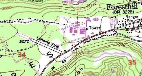
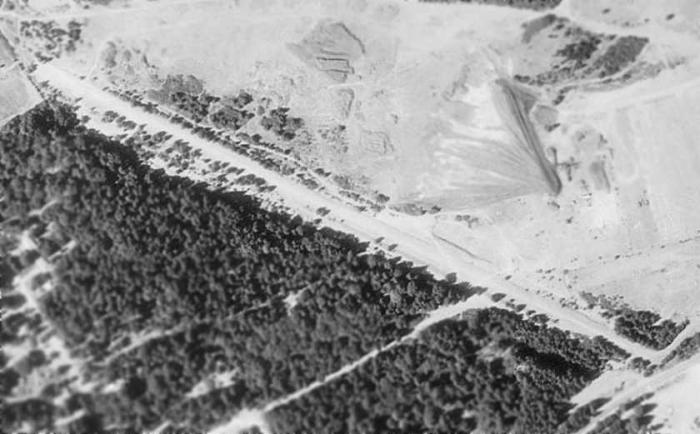

This landing strip was constructed between 1966-73. It was associated with the sawmill on the adjacent property (looks like a high school now). It was 2300' long with trees really close on each side.
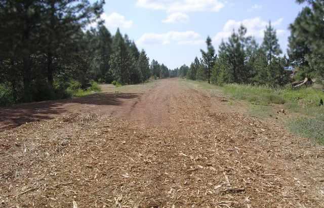
This strip is now abandoned, but is reported in good condition.
This strip is now abandoned, but is reported in good condition.
Nearby cities:
Coordinates: 39°1'5"N 120°50'21"W
- Beale Air Force Base (IATA: BAB – ICAO: KBAB) 58 km
- McClellan Airfield (KMCC/MCC) 63 km
- Sacramento Mather Airport (MHR/KMHR) 65 km
- Sacramento International Airport (KSMF/SMF) 75 km
- Travis Air Force Base (IATA: SUU, ICAO: KSUU) 128 km
- Former Castle Air Force Base 182 km
- Naval Air Station Fallon (NFL/KNFL) 188 km
- Oakland International Airport (OAK/KOAK) 188 km
- Alameda Point 188 km
- San Francisco International Airport (SFO/KSFO) 205 km
- Foresthill, California 0.5 km
- Todd Valley, California 3.1 km
- Iowa Hill Mining District 7.2 km
- Big Dipper Mine 7.3 km
- Big Gun Diggings 10 km
- Georgetown, California 12 km
- Auburn Lake Trails, California 17 km
- Garden Valley, California 19 km
- Coloma, California 24 km
- Stumpy Meadows Reservoir 25 km