Kean Bridge
Bangladesh /
Silhat /
Dhaka-Sylhet Highway :: N2 (AH 1 / AH 2)...
World
/ Bangladesh
/ Silhat
/ Silhat
World / Bangladesh / Sylhet / Sylhet / Sylhet
road bridge
Add category


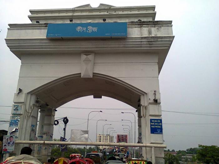
Iron Bridge of British period on Surma River, Sylhet, connecting north and south parts of Sylhet town. Keane Bridge was constructed and opened for public in the year 1936. The bridge was named after Sir Michael Keane, who was the Governor of Assam from 1932 t0 1937. Sylhet district was a part of Assam at that time. Length of the bridge is 1150 feet (351m) and the width is 18 feet (5.4m). A sum of five lakh sixty thousand Taka was spent for construction of the bridge at that period of time. Originally this bridge was used for pedestrians and vehicles. But during the visit of Mr Earl Robert Miller, Ambassador of USA to Bangladesh, he suggested to discontinue the plying of vehicles through this old bridge for safety precaution. Considering the suggestion of Mr Miller, who is also an expert in bridge engineering, only pedestrians are allowed to pass through this bridge now a days.
Nearby cities:
Coordinates: 24°53'15"N 91°52'5"E
- Shahjalal Bridge 0.9 km
- Hazrat Shahjalal Bridge 1.1 km
- Shahporan Bridge 6.6 km
- Badagut Bridge 10 km
- BRIDGE 10 km
- BRIDGE 12 km
- Chanpur Bridge 22 km
- Sunampur Bridge 22 km
- Saifur Rahman Bridge 30 km
- Bridge 38 km
- Ward No 26 0.8 km
- Ward No 22 2.1 km
- Ward No 19 2.3 km
- Ward No 10 2.8 km
- Ward No 7 2.9 km
- Ward No 21 3.1 km
- Ward No 9 3.1 km
- Ward No 24 3.2 km
- Ward No 8 3.8 km
- Sylhet District 19 km