Erbil Province (Mesîf)
Iraq /
Irbil /
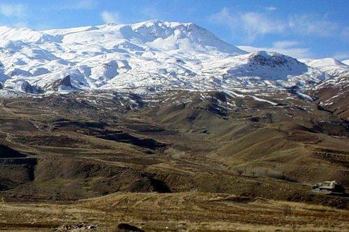
Rawanduz /
Mesîf
World
/ Iraq
/ Irbil
/ Rawanduz
, 37 km from center (راوندوز)
World / Iraq / Arbil
first-level administrative division, draw only border, governorate (administrative division)
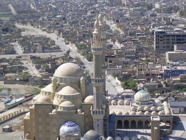
Erbil Governorate (Kurdish: Parêzgeha Hewlêr - پارێزگای ھەولێر , Arabic: محافظة أربيل) is a governorate in Iraqi Kurdistan. It derives its name from the city of Erbil (Kurdish: Hewler), which is also its capital.
Erbil Governorate covers an area of 15,074 square kilometres (5,820 sq mi) in the north of Iraq, with an estimated population (in 2011) of 2,000,000 people. It is largely populated by Kurds but has minority populations of Assyrians, Arabs, and Turkmens,
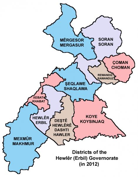
The Governorates districts are Mergasur, Soran, Choman, Rawanduz, Shaqlawa, Koye, Khabat, Erbil, Dashti Hawler, and Makhmur.
The Governorate's border is, to the West, Dohuk Governorate, in the Shamdinan and Great Zab rivers. To the South, the border is the Tigris river. To the East, the Little Zab river,close to Dukan lake and city, and to the North, the Qandil mountains in the border with
Hakkari province of Turkey and West Azaerbaijan province of Iran.
Ethnicgraphic map of Erbil province: umap.openstreetmap.fr/nl/map/erbil-province-_96691#11/3...
Erbil Governorate covers an area of 15,074 square kilometres (5,820 sq mi) in the north of Iraq, with an estimated population (in 2011) of 2,000,000 people. It is largely populated by Kurds but has minority populations of Assyrians, Arabs, and Turkmens,
The Governorates districts are Mergasur, Soran, Choman, Rawanduz, Shaqlawa, Koye, Khabat, Erbil, Dashti Hawler, and Makhmur.
The Governorate's border is, to the West, Dohuk Governorate, in the Shamdinan and Great Zab rivers. To the South, the border is the Tigris river. To the East, the Little Zab river,close to Dukan lake and city, and to the North, the Qandil mountains in the border with
Hakkari province of Turkey and West Azaerbaijan province of Iran.
Ethnicgraphic map of Erbil province: umap.openstreetmap.fr/nl/map/erbil-province-_96691#11/3...
Wikipedia article: http://en.wikipedia.org/wiki/Arbil_Governorate
Nearby cities:
Coordinates: 36°22'36"N 44°12'44"E
- Salah Al-Deen Governorate 173 km
- Nineveh Governorate (ICR) 275 km
- ِAlNajaf AlAshraf Province 464 km
- Anbar Governorate (ICR) 508 km
- Al Muthana Province 517 km
- Basra Province 605 km
- Homs Governorate (PCS) 738 km
- Rif Dimashq Governorate (PCS) 798 km
- Hadhramaut Governorate 1946 km
- Al-Mahrah Governorate 2027 km
- Military Base 3.3 km
- گۆڕەشێر 5.2 km
- بیرێژ 5.4 km
- Hivi Barzani 5.9 km
- azady quater 6.6 km
- Shaqlawa Educational Complex 8 km
- Military Installation 8.1 km
- American Village 8.5 km
- The International School of Choueifat 8.9 km
- گوندی شێخ مەمودیان 9 km
Comments