Tepi Volcano (Mount Tepi)
Ethiopia /
Southern /
Teppi /
World
/ Ethiopia
/ Southern
/ Teppi
World / Ethiopia / Southern Nations, Nationalities and Peoples / Shaka
volcano
Add category
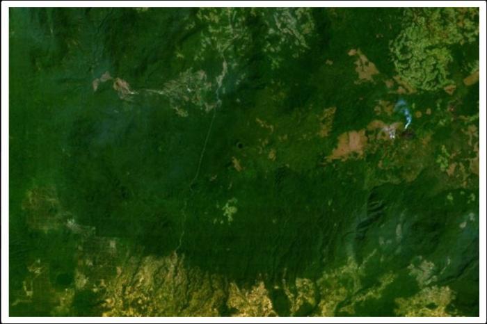
The densely forested Tepi basaltic shield volcano, morphologically unmodified in a region of high rainfall, is capped by prominent cinder cones and small craters. Three satellitic centers are located along an E-W line north of the main shield, whose 2728-m-high summit forms Ethiopia's highest Holocene volcano. Lava flows have traveled down pre-existing valleys. Tepi lies at the northern end of the Turkana rift, about 300 km west of the center of the main Ethiopian rift and was constructed along a zone of ENE-trending faults that extends in line with the Gulf of Aden. Tepi has associated active hot springs and was considered by Davidson (1983) to be of probable Holocene age.
Nearby cities:
Coordinates: 7°25'23"N 35°25'47"E
- Abyata Shala National Park 325 km
- Mega Basalt Field 399 km
- Kone volcanic complex 484 km
- Nyambene Hills, Meru 809 km
- Mallahle 931 km
- Nabro Volcano 947 km
- Bayuda Volcanic Field 1277 km
- Harra Arhab Volcanic Field 1325 km
- Jabal Meidub Volcanic Field 1366 km
- Kutum Volcanic Field 1373 km
- Bebeka farm - coffe tree, banana (mus), pineapple 54 km
- Wushwush Tea Plantation 78 km
- Alwero Reservoir 110 km
- Bonga National Forest 120 km
- Omo National Park 158 km
- Boma National Park 194 km
- Lilibai hot springs 195 km
- Gambela National Park 202 km
- Mago National Park 216 km
- Mursi Hills 219 km