Sand Cay
Philippines /
Southern Tagalog /
Taburi /
World
/ Philippines
/ Southern Tagalog
/ Taburi
World
island, reef


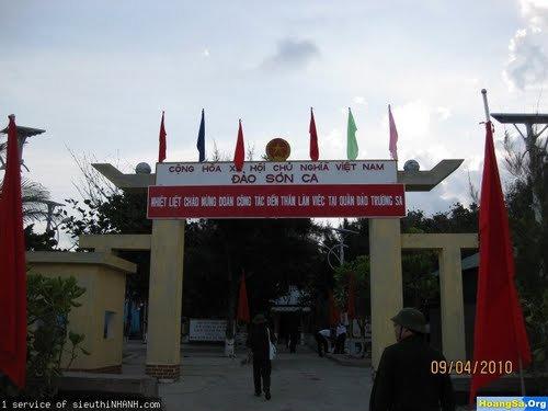
3 m high, 7 ha. Covered with trees and bushes in 1951. Fringing reef partly above water at low tide. Occupied by Vietnam.
Wikipedia article: http://en.wikipedia.org/wiki/Sand_Cay
Nearby cities:
Coordinates: 10°22'35"N 114°28'48"E
- Tizard Bank 33 km
- Kalayaan 90 km
- Jackson Reef 134 km
- Spratly Islands 152 km
- Balabac Island, Palawan 371 km
- Balambangan Island 425 km
- Banggi Island 439 km
- Malawali Island 477 km
- Pulau Jambongan 510 km
- Pulau Timbang 635 km
- Tizard Bank 11 km
- Union Bank and Reefs 59 km
- Loaita Bank 61 km
- Benitez Reef 66 km
- Kalayaan 79 km
- Livock Reef 92 km
- Alison Reef 183 km
- Fiery Cross Reef 187 km
- Cornwallis South Reef 188 km
- Cay Marino 209 km