Trade Unions Building (Kyiv)
Ukraine /
Kyyiv /
Kiev /
Kyiv /
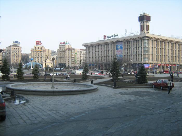
Maidan Nezalezhnosti, 2
World
/ Ukraine
/ Kyyiv
/ Kiev
, 2 km from center (Київ)
World / Ukraine / Kiev City
office building, place with historical importance, 1980_construction, trade union
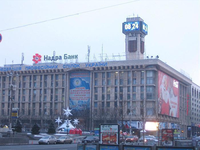
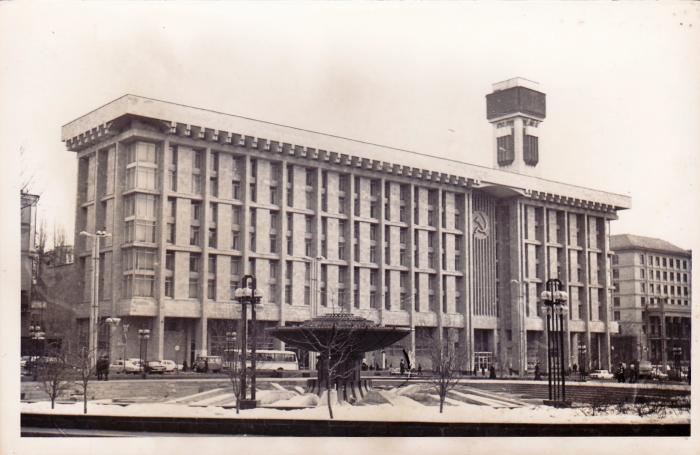
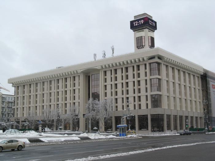

An administrative building for Ukrainian Trade Unions was built in 1978–1980.
It became famous due to the information board on its tower, which displayed the time and temperature. In 2011 it was replaced by a media screen.
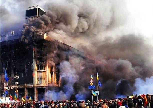
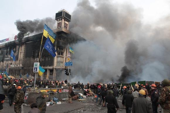
During the Euromaidan protests in 2013–2014, the building was set on fire and heavily damaged.
In 2016–2018, it was reconstructed, and reopened with a new style of its facade.
It became famous due to the information board on its tower, which displayed the time and temperature. In 2011 it was replaced by a media screen.
During the Euromaidan protests in 2013–2014, the building was set on fire and heavily damaged.
In 2016–2018, it was reconstructed, and reopened with a new style of its facade.
Wikipedia article: http://en.wikipedia.org/wiki/Trade_Unions_Building_(Kyiv)
Nearby cities:
Coordinates: 50°27'3"N 30°31'26"E
- Ukrposhta Art Khab 0.2 km
- Office Buildings 0.7 km
- vulytsia Volodymyrska, 49a 0.8 km
- vulytsia Akademika Bohomoltsia, 10 1.3 km
- Office and shopping center "Gulliver" 1.3 km
- Tower 5 1.8 km
- vulytsia Volodymyrska, 101 2.3 km
- Protasov Business Park 3.1 km
- Horizon Park II 3.4 km
- vulytsia Petra Bolbochana, 8 3.5 km
- Maidan Nezalezhnosti 0.1 km
- Khreshchatyk Boulevard 0.6 km
- Old Kyiv 0.7 km
- Lypky 0.9 km
- Service Subway Branch 1.1 km
- Central Park 1.3 km
- Pecherskyi raion 3 km
- Lybid River 4.1 km
- Shevchenkivskyi raion 4.6 km
- Kaniv Reservoir 47 km