Fleet and Industrial Supply Center, Oakland (Oakland, California)
USA /
California /
Emeryville /
Oakland, California
World
/ USA
/ California
/ Emeryville
World / United States / California
closed / former military, freight / transportation / shipping company, historical layer / disappeared object, United States Navy
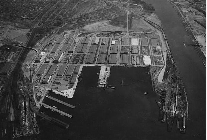
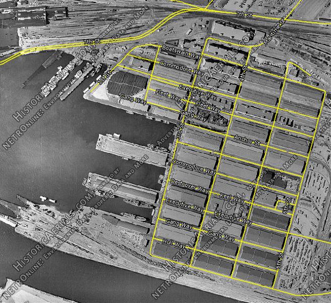

The supply depot had its origin in 1940 when the Navy bought 500 acres of wetlands from the city of Oakland for $1.00. The Navy reclaimed the land and populated it with large warehouses. It opened on December 15, 1941, and quickly began a decades-long expansion. In the late 1940s it was renamed Naval Supply Center, Oakland; later it was renamed Fleet and Industrial Supply Center, Oakland. During the Cold War, it was one of the Navy's most important supply facilities.
In 1995, the BRAC Commission recommended that the Center be closed. It was closed in 1998, and in 1999, the Navy transferred the entire 531-acre property to the Port of Oakland. The new owner developed it for intermodal marine terminal, railroad and truck cargo activities. The site is environmentally contaminated due to past activities.
A portion of the supply depot was developed into Middle Harbor Shoreline Park in 2003. Buildings were removed and environmental restoration created new wetlands for wildlife.
www.militarymuseum.org/NavSupCenOakland.html
Wikipedia article: http://en.wikipedia.org/wiki/Fleet_and_Industrial_Supply_Center,_Oakland
Nearby cities:
Coordinates: 37°48'3"N 122°19'6"W
- Oakland-Berkeley Hills Firestorm Site 10 km
- Lake Chabot Machine Gun Range (site) 20 km
- Camp Stoneman (site) 42 km
- Capell 74 km
- Hamilton Training Annex (site) 119 km
- Gold Dredging Area (former site) 128 km
- Walerga Collection Center/Camp Kohler (sites) 129 km
- Gold Dredging Area 129 km
- Gold Dredging Area 132 km
- Area of Gold Dredging 136 km
- Acorn Industrial 0.5 km
- Middle Harbor 0.9 km
- Oakland Terminals 1.3 km
- South Prescott 1.6 km
- Oakland APM Terminals - berths 20 to 24 1.9 km
- Alameda Point 2 km
- Prescott 2.3 km
- Desert Yard 2.4 km
- San Francisco-Oakland Bay Bridge 2.8 km
- San Francisco Bay 10 km
Comments