Star Tribune Image of Hugo Tornado Destruction (Hugo, Minnesota)
USA /
Minnesota /
Hugo /
Hugo, Minnesota
World
/ USA
/ Minnesota
/ Hugo
World / United States / Minnesota
historical layer / disappeared object
Add category
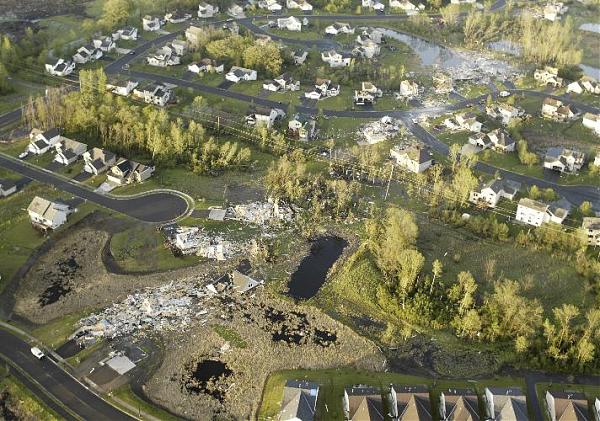
By David Brewster, Star Tribune
Nearby cities:
Coordinates: 45°10'44"N 92°59'56"W
- Hassan Township, Minnesota 52 km
- Sartell Paper Mill (demolished) 106 km
- Former Site of Minnesota Highway 23 134 km
- Former Mount Senario College 150 km
- The Belt Line Incline Railway 1889-1917 185 km
- Brooks-Scanlon lumber railroad (abandoned) 194 km
- Brooks-Scanlon Lumber Railroad (Abandoned) 203 km
- Sugar Hills 224 km
- Former Site of New York Mills Municipal Airport 234 km
- Ah-Gwah-Ching State Health Care Facility 244 km
- Peltier Lake 4.7 km
- Rice Creek Chain of Lakes Regional Park Reserve 6.1 km
- Bald Eagle Lake 6.9 km
- Bald Eagle - Otter Lakes Regional Park (Ramsey County) 7.7 km
- Rice Lake 10 km
- White Bear Lake 11 km
- Pleasant Lake 12 km
- Twin Cities Army Ammunition Plant 16 km
- Ramsey County 21 km
- Anoka County 22 km