Golestan Province
Iran /
Mazandaran /
Aliabad /
World
/ Iran
/ Mazandaran
/ Aliabad
, 34 km from center (علي آباد)
World / Iran / Golestan
province, first-level administrative division, draw only border


Golestan (Persian: گلستان, Golestān) is one of the 30 provinces of Iran, located in the northeastern part of the country, south of the Caspian Sea. Its capital is Gorgan. It was split off from the province of Mazandaran in 1997. Present-day Gorgan was called Esteraba or Astarabad until 1937. Golestan Province has a population of 1.7 million (2005) and an area of 20,380 km². The major townships of the province are: Bandar Torkaman, Bandar Gaz, Ali Abad, Kord Kooy, Gorgan, Gonbad Kavoos, Fenderesk and Minoo Dasht.
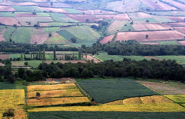
Golestan enjoys mild weather and a temperate climate most of the year. Geographically, it is divided into two sections, the plains and the mountains of the Alborz range. In the eastern Alborz section, the direction of mountains faces northeast and gradually decreases in height. The highest point of the province is Shavar, at 3,945m. in elevation.
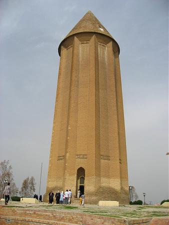
Human settlements in this area date back to 10,000 BCE. Evidence of the ancient city of Jorjan can still be seen near the current city of Gorgan. This was an important city of Persia, located on the Silk Road.
The Turkmen minority reside in the north of the province, particularly in the cities of Gonbad and Bandar Turkaman. Other minority communities such as Baluchs, Turks, Afghans, and Armenians also reside in this area, and have preserved their traditions and rituals.
Golestan enjoys mild weather and a temperate climate most of the year. Geographically, it is divided into two sections, the plains and the mountains of the Alborz range. In the eastern Alborz section, the direction of mountains faces northeast and gradually decreases in height. The highest point of the province is Shavar, at 3,945m. in elevation.
Human settlements in this area date back to 10,000 BCE. Evidence of the ancient city of Jorjan can still be seen near the current city of Gorgan. This was an important city of Persia, located on the Silk Road.
The Turkmen minority reside in the north of the province, particularly in the cities of Gonbad and Bandar Turkaman. Other minority communities such as Baluchs, Turks, Afghans, and Armenians also reside in this area, and have preserved their traditions and rituals.
Wikipedia article: http://en.wikipedia.org/wiki/Golestān_Province
Nearby cities:
Coordinates: 37°16'59"N 55°4'33"E
- Kerman Province 584 km
- Balochistan Province 785 km
- Punjab Province 1341 km
- Riyadh Province 1669 km
- Northern Borders Region 1672 km
- Mahajanga Province 5812 km
- Toliara Province 6298 km
- East Kalimantan 6975 km
- Saskatchewan 9121 km
- Papua 9200 km
Comments