Ötztal Alps
Italy /
Trentino-Alto Adige /
Silandro /
World
/ Italy
/ Trentino-Alto Adige
/ Silandro
World / Austria / Tirol
mountain, draw only border
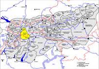
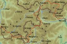


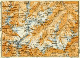
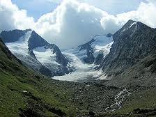
Ötztal Alps is a division of the Eastern Alps. It runs along the Austrian-Italian border. The highest point of the Ötztal Alps is Wildspitze peak, 12,379 ft (3,773 m).
Wikipedia article: http://en.wikipedia.org/wiki/Ötztal_Alps
Nearby cities:
Coordinates: 46°55'17"N 10°51'50"E
- Wildspitze 3.9 km
- Saykogel (3355 m) 14 km
- Schalfkogel (11614 ft / 3540 m) 15 km
- Mutmalspitze (11555 ft / 3522 m) 16 km
- Similaun 3599 m 17 km
- Nauderer Hennesiglspitze (3,042 m/9,980 ft) 19 km
- Lagaunspitze (3,439 m /11,283 ft) 22 km
- Saldurspitze (3,433 m /11,263 ft) 22 km
- Botzer (3,250 m/10,660 ft) 25 km
- Orgelspitze/Punta di Lasa 41 km
- Brunnenkogel 0.4 km
- Wildspitzbahn 0.7 km
- Mittelbergbahn 1.1 km
- Ski Resort: Pitztaler Gletscher. 1.9 km
- Mittelbergferner 2.4 km
- Glacier Expres 2.5 km
- Rifflsee 5.2 km
- Seekarlesferner 7.3 km
- Mittelberglesee 9 km
- Tyrol (State) 59 km