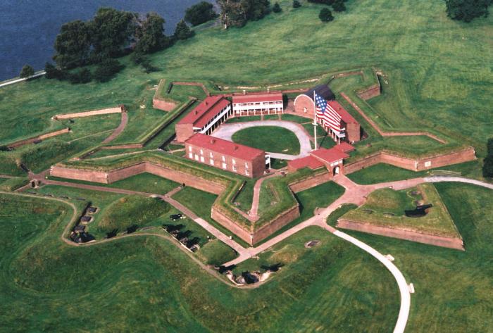
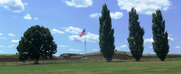
Fort McHenry National Monument & Historic Shrine (Baltimore, Maryland)
USA /
Maryland /
Baltimore /
Baltimore, Maryland /
East Fort Avenue, 2400
World
/ USA
/ Maryland
/ Baltimore
World / United States / Virginia
park, monument, NRHP - National Register of Historic Places, listed building / architectural heritage


2400 East Fort Avenue
Baltimore, MD 21230
(410) 962-4290
www.nps.gov/fomc/
The site of a battle between American soldiers and a British fleet as part of the Siege of Baltimore during War of 1812. After a day and night of bombardment the fort survived. This was the inspiration for Francis Scott Key's writing of the Star-Spangled Banner (National Anthem of the United States)- the lyrics were written on the deck of a British warship (where Key was being held) about 4 miles to the southeast.
This Second System fort was modernized as part of the Third System of fortification between 1836 and 1840.
As of 1851, it was intended to be armed with nineteen 42-pounder seacoast guns, eleven 32-pounder seacoast guns, twenty 24-pounder guns, six field pieces, seven 8" heavy seacoast howizters, two 13" mortars, seven 10" heavy mortars and two coehorn mortars, for a total of 74 guns.
Wikipedia article: http://en.wikipedia.org/wiki/Fort_McHenry
Nearby cities:
Coordinates: 39°15'49"N 76°34'51"W
- Herring Run Park 10 km
- Chinquapin Run Park 12 km
- North Point State Park 13 km
- Hart-Miller Island State Park 17 km
- Marshy Point Nature Center 20 km
- Gunpowder Falls State Park, Hammerman Area 23 km
- Bacon Ridge Natural Area 25 km
- Sandy Point State Park 28 km
- Quiet Waters Park 35 km
- Tuckahoe State Park 61 km
- North Locust Point Waterfront 1.2 km
- Locust Point Industrial Area 1.3 km
- Canton Industrial Area Waterfront 1.5 km
- Masonville Dredged Material Containment Facility & Masonville Cove Urban Wildlife Refuge 2 km
- Seagirt Marine Terminal 3.2 km
- Brooklyn 3.8 km
- Curtis Bay 4.2 km
- Brooklyn Park, Maryland 5.4 km
- Baltimore County, Maryland 19 km
- Anne Arundel County, Maryland 32 km
North Locust Point Waterfront
Locust Point Industrial Area
Canton Industrial Area Waterfront
Masonville Dredged Material Containment Facility & Masonville Cove Urban Wildlife Refuge
Seagirt Marine Terminal
Brooklyn
Curtis Bay
Brooklyn Park, Maryland
Baltimore County, Maryland
Anne Arundel County, Maryland
Comments