Benguerra Island
| national park
Mozambique /
Inhambane /
World
/ Mozambique
/ Inhambane
/ Inhambane
World / Mozambique / Inhambane / Massinga
island, national park
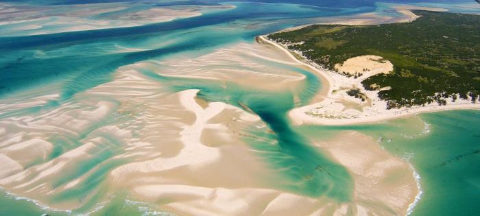
Second largest island in the Bazaruto Archipelago, which broke away from the mainland thousands of years ago.
The island is approximately 55 square kilometers (11km long x 5.5 km wide), and lies 14km offshore.
Portuguese explorers also gave the island the name Santa Antonio. It is a famous place for its unspoiled white beaches, dive sites, horseback riding and fishing.
The island is approximately 55 square kilometers (11km long x 5.5 km wide), and lies 14km offshore.
Portuguese explorers also gave the island the name Santa Antonio. It is a famous place for its unspoiled white beaches, dive sites, horseback riding and fishing.
Wikipedia article: http://en.wikipedia.org/wiki/Benguerra_Island
Nearby cities:
Coordinates: 21°51'36"S 35°26'24"E
- Bazaruto Island 39 km
- Bassas da India 436 km
- Domwe Island 881 km
- Likoma Island 1097 km
- Ibo 1194 km
- Matemo Island 1207 km
- Quifuqui 1309 km
- Mohéli 1378 km
- Anjouan 1433 km
- Grande Comore 1433 km
- Bazaruto Island View Estate 15 km
- Bazaruto Island Airport (BZB) 17 km
- Willie van Straten 41 km
- Bartolomeu Dias Anchorage, Mozambique 87 km
- Nova Sofala 208 km
- Porto (CFM_CENTRO) 236 km
- Beira Airport 236 km
- ESSAR COAL & IRON ORE TERMINAL 239 km
- Capital Foods Lda, Beira 241 km
- Maeva Dondo 257 km