Nojeokbong (Mokpo City)
Korea (South) /
Chollanam /
Mokpo /
Mokpo City
World
/ Korea (South)
/ Chollanam
/ Mokpo
World / South Korea / Jeollanam-do
peak
Add category
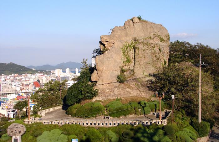
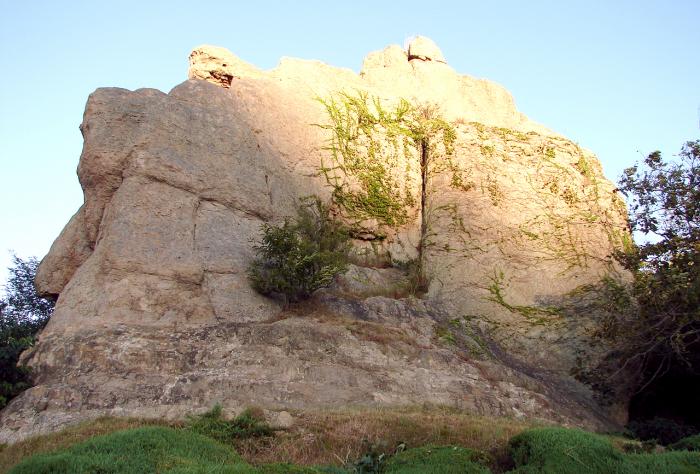
Nojeokbong is a rocky mountain peak rising 60m above sea level.
During the Japanese invasion in 1592 Admiral Lee Sun-Sin had this peak covered with straw thatch so that it looked like a huge cache of food and stationed a small force of infantry to defend it.
Upon surveying the sight, the invading Japanese mistakenly over estimated the garrisoned force believing that the food cache to be enough to support a much larger force. So the Japanese abandoned their assault plans and fled. Afterwards, people called this peak Nojeokbong, meaning stack in English.
Nearby cities:
Coordinates: 34°47'19"N 126°22'53"E
- Gitdaebong (깃대봉) 36 km
- Guksabong (국사봉) 38 km
- Sanghwangbong (상황봉) 55 km
- Songdaebong 77 km
- Gaebong (개봉) 84 km
- Janggunbong (장군봉) 103 km
- Gitdaebong 109 km
- Chisulryeong 278 km
- Manhobong 291 km
- Siru Peak (시루봉) 296 km
- North port 2.8 km
- Mokpo New Port 3.8 km
- HYUNDAI SAMHO Heavy Industries Shipyard 5.4 km
- Nuldo (눌도) 5.6 km
- Daebul Industrial Complex 5.7 km
- Dalrido (달리도) 6 km
- Geumhodo 11 km
- Amhaedo 12 km
- Mokpo VLF Transmitter 13 km
- Washington harbour 23 km