Elberta, Utah
USA /
Utah /
Elberta /
World
/ USA
/ Utah
/ Elberta
World / United States / Utah
CDP - Census Designated Place
Add category

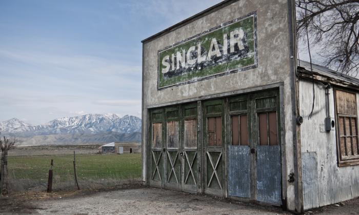
Elberta is a census-designated place (CDP) in Utah County, Utah, United States. It is part of the Provo–Orem Metropolitan Statistical Area. The population was 256 at the 2010 census. It is also known as "The Slant".[citation needed] It was founded as "Mt. Nebo". After the water failed in 1901 most of the early settlers moved away. It was purchased by Mr. Matthew B. Whitney, a native of New York, on November 7, 1907, and Mr. Whitney renamed it "Elberta" after the peach.
Wikipedia article: http://en.wikipedia.org/wiki/Elberta,_Utah
Nearby cities:
Coordinates: 39°58'24"N 111°57'0"W
- Randlett , Utah 176 km
- La Sal, Utah 286 km
- Redlands, Colorado 291 km
- Parks, Arizona 504 km
- Allenspark 535 km
- Munds Park 556 km
- Black Forest, Colorado 622 km
- Ak-Chin Village, Arizona 768 km
- Three Points 876 km
- Chaparral, New Mexico 1006 km
- Center pivot irrigation 5.3 km
- Goshen Bay 8 km
- Pinyon Peak 10 km
- Sioux Peak 14 km
- Eureka Peak 15 km
- Mammoth, Utah 16 km
- Silver City, Utah 17 km
- Clyde Knoll 4750' 19 km
- Mount Nebo Wilderness Area 21 km
- Utah Lake 27 km