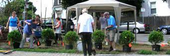
Wikimapia Search
World
/
USA
/
Massachusetts
/
Boston
, 4 km from center
Coordinates: 42°19'17"N 71°3'19"W
Sharon's Park-
(Boston)
Category:
park
Permalink to this place
place comments:
add your comment in English
Vietnamese foods, market, services, pharmacy
Savin Hill, MBTA Station
Savin Hill - Dorchester, Ma
The Boston Globe
WLVI Channel 56 / Boston's CW
Greater Media Radio Studios
UMass Boston Campus
GIS Lab
Wheatley Hall
McCormack Hall
Science Center
Healey Library
Huru (sculpture) by Mark di Suvero
Boston College High School
BC High building
Peninsula Apartments
Quinn Administration
Service Building
Clark Athletic Center
Paul A. Dever School
New Store on The Block
Tran's Dental Office
JFK/Umass Red Line Subway Station
AEolian-Skinner Organ Co.
Interstate 93 Exit 15 - Columbia Road
Shaw's supermarket
Maria Maket, Diem Nguyen
Joseph Moakley Park
Bayside Expo Center
Doubletree Club Hotel Bayside
Harbor Point Apartments
Columbia Point
Fields Corner Post Office
Victory Road Park
Westminster Dodge
National Grid Gas Tank - "Rainbow Swash"
IBEW Local 103 JATC Training Center
Site of Local 103 Wind turbine
IBEW Local 103 Boston
Little Saigon
Dorchester Yacht Club
Savin Hill Beach
Malibu Beach
Boston Scientific - Quincy
Naval Air Station Squantum
Remains Of Harvad Aviation Field/Squantum Naval Air Station
Harvard Aviation Field / Squantum Naval Air Station
WaterWorks
Marina Bay
Waterclub
Campus Center
Boston
John F. Kennedy Presidential Library and Museum
Massachusetts Archives and Commonwealth Museum
Former Sewage Pumping Station (1883)
KML
Edited: 21 months ago
Languages:
en