Bruning Army Airfield
USA /
Nebraska /
Ohiowa /
World
/ USA
/ Nebraska
/ Ohiowa
World / United States / Nebraska
abandoned / shut down, Army Air Field US
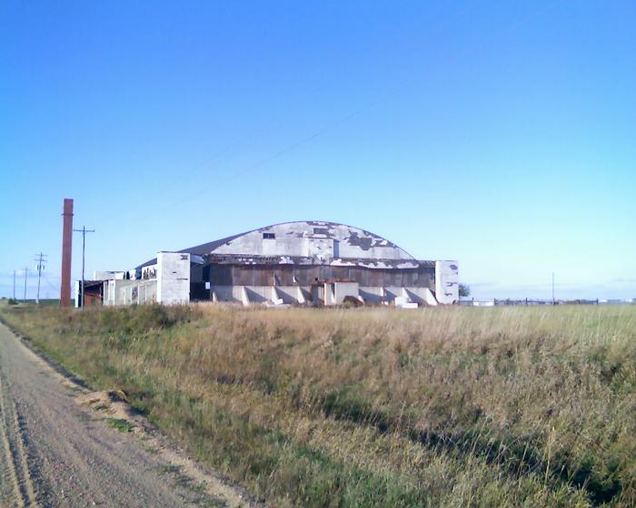
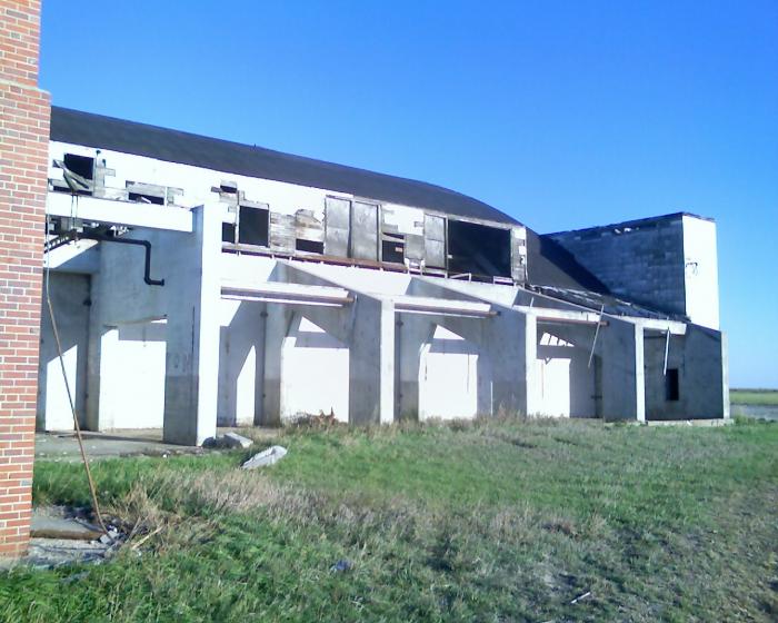
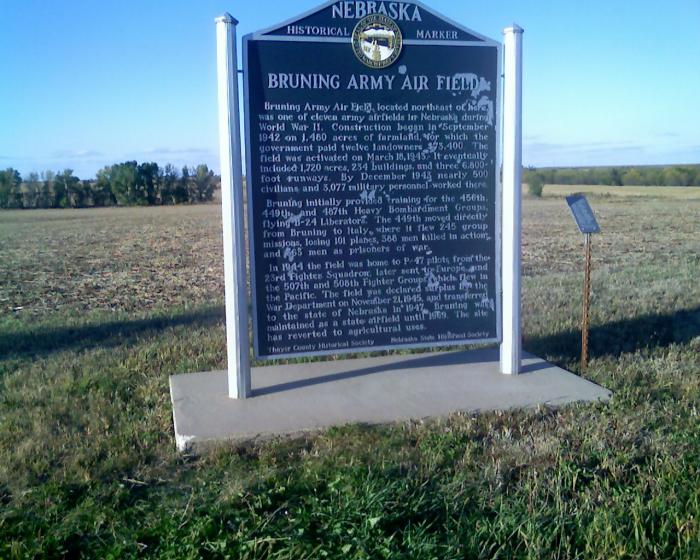
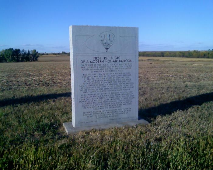
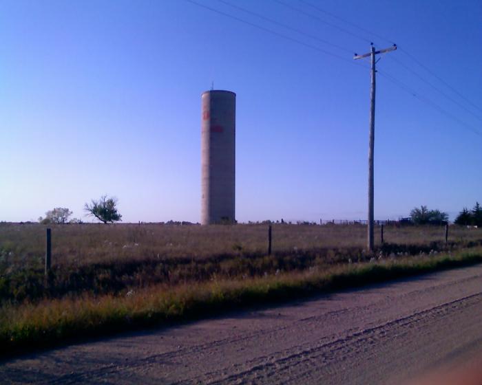
This abandoned airfield was built during WW2 for the Army Air Corps' 2nd Air Force.
It was a substantial airfield, having three 6,800' paved runways, taxiways,
numerous dispersal pads along the taxiways,
and 2 paved aprons, one of which measured 2,135' x 600'.
www.airfields-freeman.com/NE/Airfields_NE_SE.htm#brunin...
It was a substantial airfield, having three 6,800' paved runways, taxiways,
numerous dispersal pads along the taxiways,
and 2 paved aprons, one of which measured 2,135' x 600'.
www.airfields-freeman.com/NE/Airfields_NE_SE.htm#brunin...
Wikipedia article: http://en.wikipedia.org/wiki/Bruning_Army_Airfield
Nearby cities:
Coordinates: 40°20'20"N 97°25'36"W
- Hastings Air Force Station 78 km
- Former BN Nebraska City Bridge 140 km
- The Now Closed Original Salina Airport 169 km
- Walker Army Airfield (Closed) 215 km
- Former Atlas F Missile Silo 224 km
- Wild West World 280 km
- Runway 01R/19L 301 km
- Winfield Gap-Filler Radar Site (Kansas, USA) 350 km
- Dodge City Army Air Field 366 km
- Abandoned Railway Bridge 420 km
- Alexandria State Recreation Area 14 km
- Hebron Country Club 25 km
- Hebron Municipal Airport (KHJH) 25 km
- Fairbury Municipal Airport (FBY/KFBY) 28 km
- Weiss Lagoon Waterfowl Production Area 30 km
- Fairgrounds 32 km
- Buckley Creek State Recreation Area 32 km
- Fairbury Cemetery 33 km
- Endicott Clay Products 40 km
- Rock Creek Station State Recreation Area/State Historical Park 40 km
Alexandria State Recreation Area
Hebron Country Club
Hebron Municipal Airport (KHJH)
Fairbury Municipal Airport (FBY/KFBY)
Weiss Lagoon Waterfowl Production Area
Fairgrounds
Buckley Creek State Recreation Area
Fairbury Cemetery
Endicott Clay Products
Rock Creek Station State Recreation Area/State Historical Park