Santa Teresa (Rio de Janeiro)
Brazil /
Rio de Janeiro /
Rio de Janeiro
World
/ Brazil
/ Rio de Janeiro
/ Rio de Janeiro
World / Brazil / Rio de Janeiro / Rio de Janeiro
neighbourhood, invisible
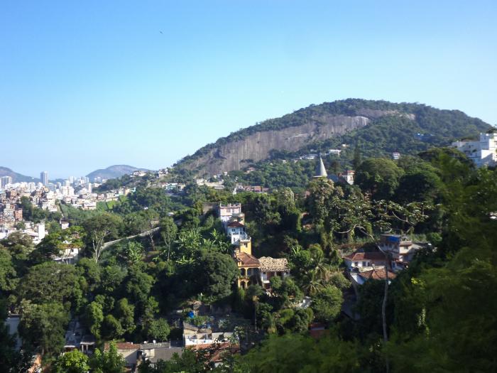

Santa Teresa is the name of a neighbourhood in the city of Rio de Janeiro, Brazil. It is located on top of the Santa Teresa hill, by the centre of Rio, and is famous for its winding, narrow streets which are a favourite spot for artists and tourists.
The neighbourhood originated around the Santa Teresa Convent, built in the 1750s on the Desterro hill. At the end of the 19th and early 20th century it was an upper class borough, as testified by its magnificent mansions, many of which are still standing.
Santa Teresa ceased being an upper class neighbourhood long ago, but it has been revived as an artistic hotspot. It is home to several artists and art studios and galleries. The offer of restaurants and bars is also varied.
Wikipedia article: http://en.wikipedia.org/wiki/Santa_Teresa_(Rio_de_Janeiro)
Nearby cities:
Coordinates: 22°55'55"S 43°11'53"W
- Laranjeiras 0.7 km
- Botafogo 0.9 km
- Urca 2.2 km
- Rio Comprido 2.9 km
- Copacabana 3.1 km
- Lagoa 4.3 km
- Jardim Botânico, Rio de Janeiro 5.2 km
- Ipanema 5.3 km
- Leblon 6.3 km
- Gávea 7.3 km
- Favela do Coroado 0.6 km
- Quinta da Santa Alexandrina Building 1 km
- Cesgranrio Foundation 1.1 km
- Rebouças Tunnel (North Entry/Exit) 1.2 km
- HCAP 1.2 km
- Elevado Paulo de Frontin 1.6 km
- Tijuca National Park (Sector B - Carioca Range/Corcovado) 4.9 km
- Guanabara Bay 14 km