Civil Lines (Delhi)
| region
India /
Delhi /
Delhi
World
/ India
/ Delhi
/ Delhi
World / India / Delhi / Delhi
region
Add category
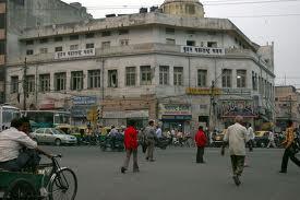
Civil Lines (archaically White Town) are the residential neighborhoods developed during the British Raj for its senior civilian officers like Divisional commissioner and District magistrate. These townships were built all over the Indian subcontinent and were allotted to civil officers in the respective countries. This is distinct from Forts and Cantonments, which were expressedly military establishments.
Wikipedia article: http://en.wikipedia.org/wiki/Civil_Lines
Nearby cities:
Coordinates: 28°40'56"N 77°13'25"E
- Guru Tegh Bahadur Nagar 4.2 km
- Central New Delhi 8 km
- Lal Bagh 8.2 km
- Sector 8 11 km
- Mayapuri 12 km
- Hauz Khas 14 km
- Badarpur 20 km
- Gopal Nagar 26 km
- Issapur Forest area 39 km
- M - 11, Manesar 47 km
- Northern Ridge 0.9 km
- Khyber Pass 1 km
- Chandrawal Water Works 1 km
- IyrinHealth Care 1.2 km
- St Stephen's College 1.3 km
- Delhi University 1.4 km
- New Malka Ganj 1.5 km
- Garhi Mendu City Forest 2.5 km
- North Delhi 6.8 km
- Ghaziabad District 24 km