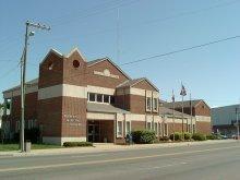
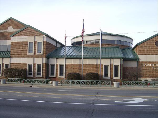
Plainfield Municipal Building (site) (Plainfield, Indiana)
USA /
Indiana /
Plainfield /
Plainfield, Indiana /
West Main Street, 206
World
/ USA
/ Indiana
/ Plainfield
World / United States / Indiana
historical layer / disappeared object
Add category

Nearby cities:
Coordinates: 39°42'10"N 86°24'12"W
- Indiana National Guard - Stout Field Armory 15 km
- GM Guide Lamp Division Anderson, IN Plant (site) 73 km
- Flinn Township (extinct) 92 km
- 2009 Fayetteville tornado 95 km
- Jefferson Proving Ground 107 km
- Point of Entry of the Wabash River into Indiana 167 km
- Cincinnati Subway (Abandoned) 173 km
- Air Force Plant No. 36 175 km
- Former PRR Bradford terminal & yard 175 km
- Miami & Erie Canal 235 km
- Central Plainfield 0.2 km
- Al & Jan Barker Sports Complex 0.7 km
- Indiana Department of Correction - Heritage Trail Correctional Facility 1.1 km
- Indiana Department of Correction - Plainfield Correctional Facility 1.8 km
- Hummel Park 2.6 km
- Oak Tree Golf Course 3.5 km
- Cartersburg, Indiana 5.4 km
- Belleville, Indiana 7.8 km
- Deer Creek Golf Club 8.3 km
- Hendricks County, Indiana 11 km
Central Plainfield
Al & Jan Barker Sports Complex
Indiana Department of Correction - Heritage Trail Correctional Facility
Indiana Department of Correction - Plainfield Correctional Facility
Hummel Park
Oak Tree Golf Course
Cartersburg, Indiana
Belleville, Indiana
Deer Creek Golf Club
Hendricks County, Indiana