The Largest Preistoric Fortification in Europe "Cornesti- Iarcuri"(1500-1000 B.C.)
Romania /
Timis /
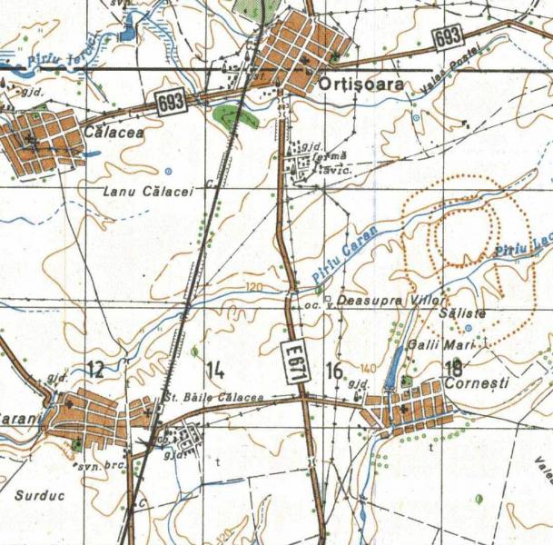
Ortisoara /
World
/ Romania
/ Timis
/ Ortisoara
World / Romania
ancient, archaeological site, mysterious, prehistoric, interesting place, draw only border
THE LARGEST PREISTORIC FORTIFICATION IN EUROPE
"CORNESTI - IARCURI"- BANAT, ROMANIA
A massive Late Bronze Age (1500- 1100 BC) fortified settlement in Romania
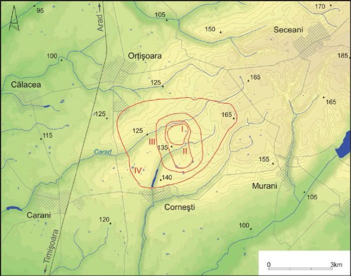
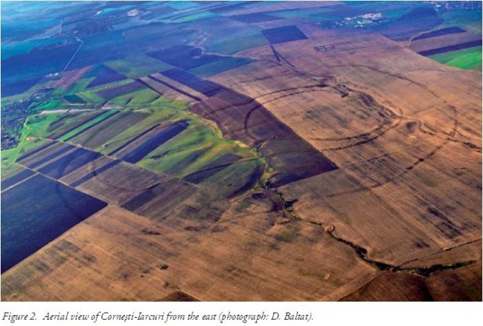
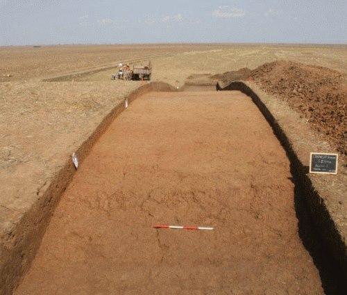
The site, located in the plains of the Banat in western Romania, is almost 6 km across, dwarfing any other known prehistoric settlement in Europe.
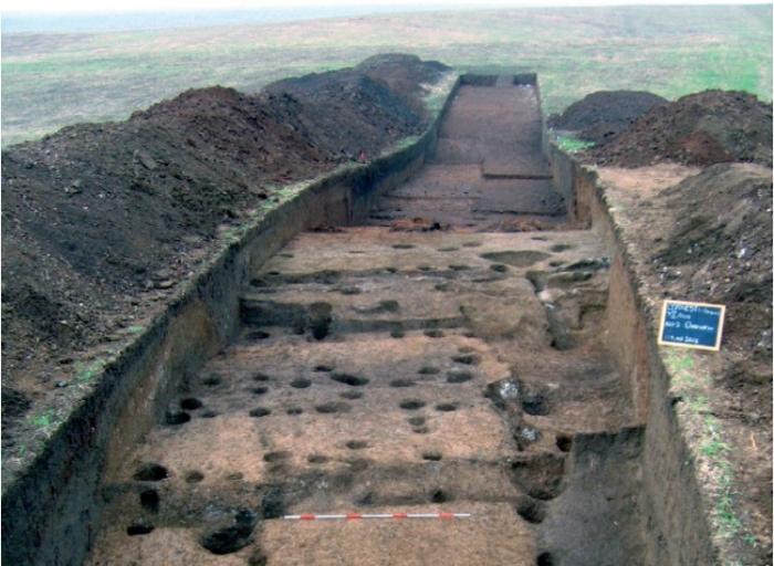
A massive Late Bronze Age fortified settlement in Central Europe has been the subject of a new and exemplary investigation by excavation and site survey.
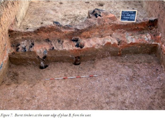
This prehistoric enclosure, nearly 6 km across, had a complex development, dense occupation and signs of destruction by fire. It can hardly be other than a capital city playing a role in the determinant struggle sofitsday—weighty and far reaching events of the European continent now being chronicled by archaeology.
The total area of over 1700ha is that of the outermost ring (Enclosure IV), which measures 5.5 km east–west and c . 3.9 km north–south, with a perimeter length of almost 16 km.
www.youtube.com/watch?v=oNZiAHx11N8
"CORNESTI - IARCURI"- BANAT, ROMANIA
A massive Late Bronze Age (1500- 1100 BC) fortified settlement in Romania
The site, located in the plains of the Banat in western Romania, is almost 6 km across, dwarfing any other known prehistoric settlement in Europe.
A massive Late Bronze Age fortified settlement in Central Europe has been the subject of a new and exemplary investigation by excavation and site survey.
This prehistoric enclosure, nearly 6 km across, had a complex development, dense occupation and signs of destruction by fire. It can hardly be other than a capital city playing a role in the determinant struggle sofitsday—weighty and far reaching events of the European continent now being chronicled by archaeology.
The total area of over 1700ha is that of the outermost ring (Enclosure IV), which measures 5.5 km east–west and c . 3.9 km north–south, with a perimeter length of almost 16 km.
www.youtube.com/watch?v=oNZiAHx11N8
Nearby cities:
Coordinates: 45°56'4"N 21°14'9"E
- Satchinez Swamps reservation 21 km
- Diniaş Salt pans 36 km
- Red Hill 36 km
- Lugoj 54 km
- Tapia 63 km
- Smida valley 68 km
- Tripoint: Romania, Hungary, Serbia (1m resolution imagery) 81 km
- Tămaşda 84 km
- Camping area "Mrtva Tisa" 102 km
- The Ópusztaszer National Historical Memorial Park 108 km
- Orţişoara 1.9 km
- Satimpex Fishing Area 7.2 km
- Sânandrei 7.7 km
- Giarmata 11 km
- Hodoni 12 km
- Pischia 12 km
- Dudestii Noi 13 km
- Timişoara metropolitan area 15 km
- Satchinez 16 km
- Becicherecu Mic 19 km
Comments