Chornobyl-2 Military Camp
Ukraine /
Kyyivska /
Prypyat /
World
/ Ukraine
/ Kyyivska
/ Prypyat
, 8 km from center (Припьять)
World / Ukraine / Kiev
ghost town
Add category


Chornobyl-2 is located northwest of the small town of Chornobyl in Polissia region of Ukraine, but it is impossible to find on any topographical map.
Exploring the maps, you are likely to find a symbol for a children's boarding house, or a dotted line of forest roads on a place of accommodation of the town, but no reference to urban and technical buildings. In the USSR, they were able to hide a secret, even more so if it was a military secret.
Details – www.chornobyl.in.ua/en/chernobyl-2.htm
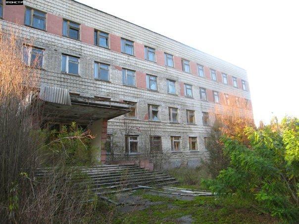
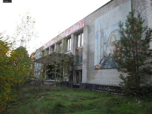
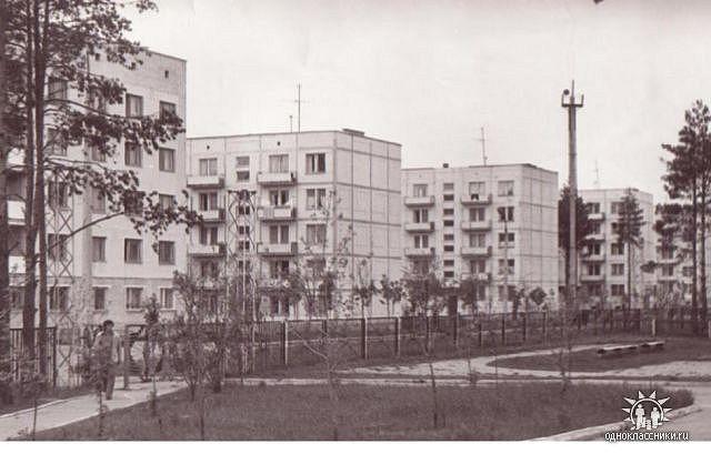
Chornobyl-2 was a former secret military settlement in Ukraine, located in the Ivankiv district of Kyiv Oblast. Before the Chornobyl disaster, it was administratively part of the Chornobyl district. The settlement was evacuated due to radioactive contamination caused by the Chornobyl Nuclear Power Plant catastrophe and is now within the Chornobyl Exclusion Zone.
Chornobyl-2 was established to serve the secret "Duga" facility, a radar system designed to detect the launch of intercontinental ballistic missiles. The facility and the settlement were built in the mid-1970s. After the Chornobyl disaster, this area became part of the exclusion zone.
Exploring the maps, you are likely to find a symbol for a children's boarding house, or a dotted line of forest roads on a place of accommodation of the town, but no reference to urban and technical buildings. In the USSR, they were able to hide a secret, even more so if it was a military secret.
Details – www.chornobyl.in.ua/en/chernobyl-2.htm
Chornobyl-2 was a former secret military settlement in Ukraine, located in the Ivankiv district of Kyiv Oblast. Before the Chornobyl disaster, it was administratively part of the Chornobyl district. The settlement was evacuated due to radioactive contamination caused by the Chornobyl Nuclear Power Plant catastrophe and is now within the Chornobyl Exclusion Zone.
Chornobyl-2 was established to serve the secret "Duga" facility, a radar system designed to detect the launch of intercontinental ballistic missiles. The facility and the settlement were built in the mid-1970s. After the Chornobyl disaster, this area became part of the exclusion zone.
Nearby cities:
Coordinates: 51°18'28"N 30°4'29"E
- Chornobyl 8.6 km
- Prypiat 13 km
- Tovstyi Lis 23 km
- Denysovychi 35 km
- Martynovychi 35 km
- Novyi Myr 36 km
- Buda-Varovychi 42 km
- Poliske 50 km
- Vilcha 50 km
- Chernobyl Region Settlement (Abandoned 1986) Village of Narodichskogo / Великие Клещи 69 km
- Phased antenna array 0.7 km
- Chornobyl-2 "Russian Woodpecker" - OTH Radar of type "DUGA-1" 0.7 km
- Korohodskyi Forest 3.7 km
- Air defence base territory 3.9 km
- Ruins of Anti-Aircraft S-75 (NATO: SA-2 Guideline) Missile Site 3.9 km
- The kalininskoe gremovo tract 4.1 km
- Farm yard 4.8 km
- Chernobyl Cooling Pond Island 7.9 km
- Cooling pond 7.9 km
- Chornobyl Exclusion Zone 11 km
Phased antenna array
Chornobyl-2 "Russian Woodpecker" - OTH Radar of type "DUGA-1"
Korohodskyi Forest
Air defence base territory
Ruins of Anti-Aircraft S-75 (NATO: SA-2 Guideline) Missile Site
The kalininskoe gremovo tract
Farm yard
Chernobyl Cooling Pond Island
Cooling pond
Chornobyl Exclusion Zone