Former DYE-4/Kulusuk Island DEW Line Radar Site
Greenland /
Ammassalik /
Kulusuk /
World
/ Greenland
/ Ammassalik
/ Kulusuk
World
Cold War 1947-1991, telecommunication, closed / former military, mobile phone transmitter / mast, early warning radar
Call Sign: Big Gun
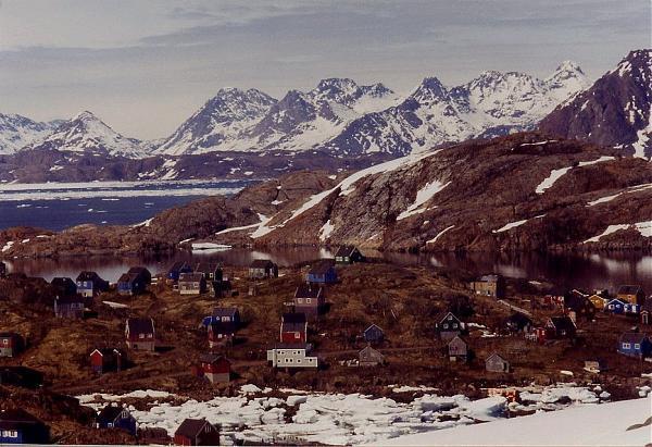
Constructed in the late 1950's and placed into operation in 1961, the DYE-4 or Kulusuk Island Radar Site was a long-range radar site in the DYE Sector for the Distant Early Warning Line, or DEW Line, and was the Easternmost of four sites located on Greenland. Linked by troposcatter communication lines Eastward to the DYE-5 site located at Rockville, Iceland and West to the DYE-3 site located atop the Greenland Ice Cap, the DYE-4 site monitored its portion of airspace over Greenland and the Denmark Strait against Soviet air attack with its single AN/FPS-30 radar system.
Located atop a seaside mountain at an altitude of 1,081ft above sea level, the DYE-4 site was frequently exposed to severe North Atlantic storms and gales with winds in excess of 140 knots being frequently recorded. As a result of this exposed position, the site had the majority of its buildings and its primary radar building wrapped in bedrock-anchored steel cable to prevent them from being blown away during the frequent storms that lashed the site. Despite these measures, the site was severely damaged and knocked offline by storms in 1969 and 1973. The station was linked to its support airfield and contractor operations base in nearby Kulusuk by a winding 5-mile road which was often rendered impassible by deep snow drifts during the winter months.
Operational in its DEW Line role through 1991, the site was the final DEW station to be formally shut down when its last staff were ordered to terminate operations on September 24th, 1991. Largely idle thereafter as it was not re-used as part of the North Warning System, the majority of the site's DEW Line buildings were ravaged by the weather conditions during the subsequent years before being demolished and removed as part of a site remediation project in the early 2000's. Today none of the DEW-era structures at the former DYE-4 site remain, although the site remains active as a transmission site for both Tele Greenland & Naviair communications.
lswilson.dewlineadventures.com/dye4pics.htm
lswilson.dewlineadventures.com/dye4storm73.htm
Wikipedia article: http://en.wikipedia.org/wiki/DYE_Stations
Nearby cities:
Coordinates: 65°31'38"N 37°9'41"W
- Holy Loch 2014 km
- Former tank training ground 2337 km
- Former RAF Elvington 2354 km
- Former RAF Binbrook 2428 km
- Kendrew Barracks (former RAF Cottesmore) 2468 km
- Former RAF Upper Heyford 2510 km
- Alconbury Developments Limited (Former RAF Alconbury) 2516 km
- Former RAE Bedford /RAF Thurleigh 2519 km
- Terrain Militaire de Souges 3171 km
- 120 Airbase Cazaux 3190 km
- Kulusuk Airport (KUS/BGKK) 5.4 km
- Ammassalik (Greenland) 23 km
- Kuummiut 38 km
- Pupik, Greenland (Østgrønland) 44 km
- Tiniteqilaaq 49 km
- Ikatseq / Bluie East 2 51 km
- Sermiligaaq 55 km
- Isortoq 84 km
- Helheim Glacier 114 km
- Approximate landing area of the "Lost Squadron" of 1942 147 km