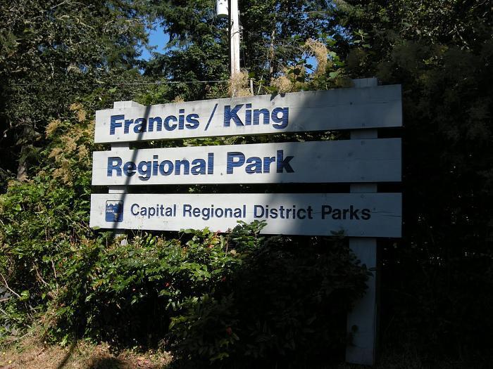
Francis King Regional Park (Victoria)
Canada /
British Columbia /
Victoria
World
/ Canada
/ British Columbia
/ Victoria
World / Canada / British Columbia / Capital
mountain, park, hiking, region
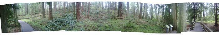
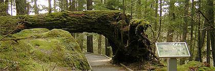
11 kilometres of woodland trails, they connect to Thetis Lake Regional Park. There is also a nature centre and picnic area. Main trail is on cedar boardwalks, which makes for easier walking.
Nearby cities:
Coordinates: 48°28'56"N 123°26'47"W
- Mt Douglas Park 7.1 km
- Mount Work 7.4 km
- Triangle Mountain 7.8 km
- Mount Wells Regional Park 9 km
- Mount Newton (John Dean Provincial Park) 16 km
- Turtleback Mountain 40 km
- Mount Constitution 48 km
- Mount Storm King 51 km
- Galbraith Mountain 80 km
- Lookout Mountain Preserve 83 km
- Thetis Lake Regional Park 2.2 km
- Thetis Heights Neighbourhood 3.7 km
- Glanford 4 km
- Esquimalt Harbour 4.4 km
- Tillicum 4.8 km
- The Gorge Waterway / Portage Inlet 5.3 km
- Elk/Beaver Lake Regional Park 5.7 km
- Hartland MTB Trails - Mountain Bike Courses 5.8 km
- Gowlland Tod Provincial Park 7.1 km
- Saanich Inlet 13 km