Ujung Kulon National Park
Indonesia /
Banten /
Labuhan /
World
/ Indonesia
/ Banten
/ Labuhan
World / Indonesia / Banten
park, forest, threatened species habitat, UNESCO World Heritage Site, national park, animal sanctuary

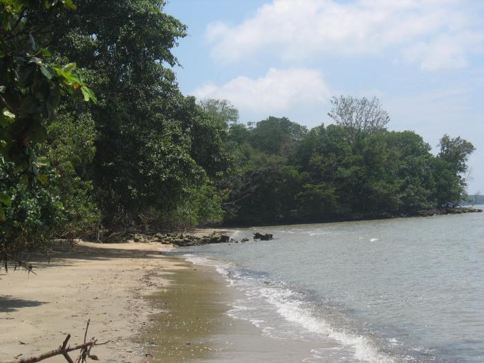

Ujung Kulon National Park is located at the western-most tip of Java, Indonesia. It includes the volcanic island group of Krakatoa and other islands including Handeuleum and Peucang. The park encompasses an area of 1,206 km² (443 km² marine), most of which lies on a peninsula reaching into the Indian Ocean.
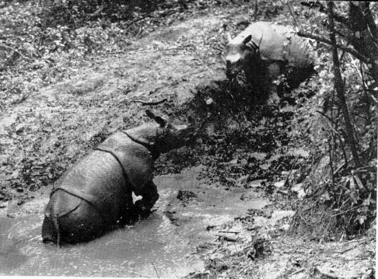
It is Indonesia's first national park and was declared a UNESCO World Heritage Site in 1992 for containing the largest remaining lowland rain-forest in Java. It is also one of only two homes of the critically endangered Javan Rhinoceros [in photo, circa 1930]. A population of fifty to sixty live in Ujung Kulon, a smaller population of possibly 10 or less, live in Cat Tien National Park, Vietnam. The mainland part of Ujung Kulon was formerly farmland until it was devastated and depopulated by the 1883 eruption of Krakatoa after which it returned to its original forested state.
Permits for the park are available at the town of Labuan, where there is a National Park office. There is also an office at Tamanjaya. Accommodation is available on Handeuleum and Peucang islands.
In 2005 the Ujung Kulon National Park has been designated as an ASEAN Heritage Park.
whc.unesco.org/pg.cfm?cid=31&id_site=608
www.unep-wcmc.org/sites/wh/pdf/Ujung%20Kulon.pdf
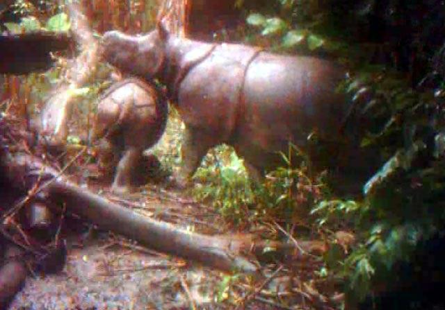
Colored photographs showed encouraging findings released by WWF-Indonesia and Central TN Ujung Kulon. Video Camera traps (traps video) successfully documented the existence of two pairs of parent Javan rhinoceros (Rhinoceros sondaicus) and daughter in Ujung Kulon National Park area during November and December 2010.
It is Indonesia's first national park and was declared a UNESCO World Heritage Site in 1992 for containing the largest remaining lowland rain-forest in Java. It is also one of only two homes of the critically endangered Javan Rhinoceros [in photo, circa 1930]. A population of fifty to sixty live in Ujung Kulon, a smaller population of possibly 10 or less, live in Cat Tien National Park, Vietnam. The mainland part of Ujung Kulon was formerly farmland until it was devastated and depopulated by the 1883 eruption of Krakatoa after which it returned to its original forested state.
Permits for the park are available at the town of Labuan, where there is a National Park office. There is also an office at Tamanjaya. Accommodation is available on Handeuleum and Peucang islands.
In 2005 the Ujung Kulon National Park has been designated as an ASEAN Heritage Park.
whc.unesco.org/pg.cfm?cid=31&id_site=608
www.unep-wcmc.org/sites/wh/pdf/Ujung%20Kulon.pdf
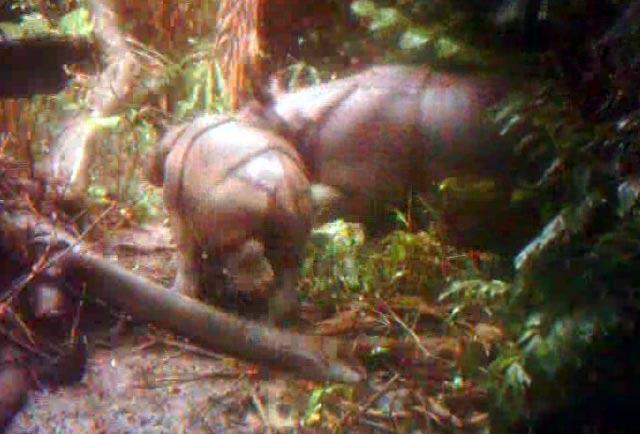
Colored photographs showed encouraging findings released by WWF-Indonesia and Central TN Ujung Kulon. Video Camera traps (traps video) successfully documented the existence of two pairs of parent Javan rhinoceros (Rhinoceros sondaicus) and daughter in Ujung Kulon National Park area during November and December 2010.
Wikipedia article: http://en.wikipedia.org/wiki/Ujung_Kulon_National_Park
Nearby cities:
Coordinates: 6°45'37"S 105°27'18"E
- Ningaloo Reef 1885 km
- Lorentz National Park 3508 km
- Selous Game Reserve 7653 km
- Ngorongoro Conservation Area 7839 km
- Serengeti National Park 7965 km
- Virunga National Park 8531 km
- Kahuzi-Biéga National Park 8665 km
- Maiko National Park 8760 km
- Salonga National Park (North) 9428 km
- Salonga National Park (South) 9484 km
- Slamadarang Bay 4.3 km
- Lorogan Cilintang (Bay) 5.9 km
- Legon Keusiklega 10 km
- Peucang Island 22 km
- Panaitan Strait 22 km
- Layar Point 24 km
- Teluk Sarimo 36 km
- Legon Sabini 37 km
- Weton Cape 41 km
- Banten 64 km
Comments